9 National Park Trails Closing Forever in 2026 (Last Chance to See)

Footsteps fade faster than most people realize. One season you’re following a ribbon of dirt through silence and sunlight, and the next, that same path exists only in old photos and half-remembered stories.
Across America’s most treasured landscapes, access is quietly shrinking — not with dramatic announcements, but with locked gates, detours, and “closed indefinitely” signs that never come down.
These aren’t just routes on a map; they’re experiences shaped by effort, weather, and timing. Miss the window, and they’re gone. What follows isn’t a list built on hype, but a last call for views, moments, and trails that won’t wait.
1. Cleetwood Cove Trail — Crater Lake National Park
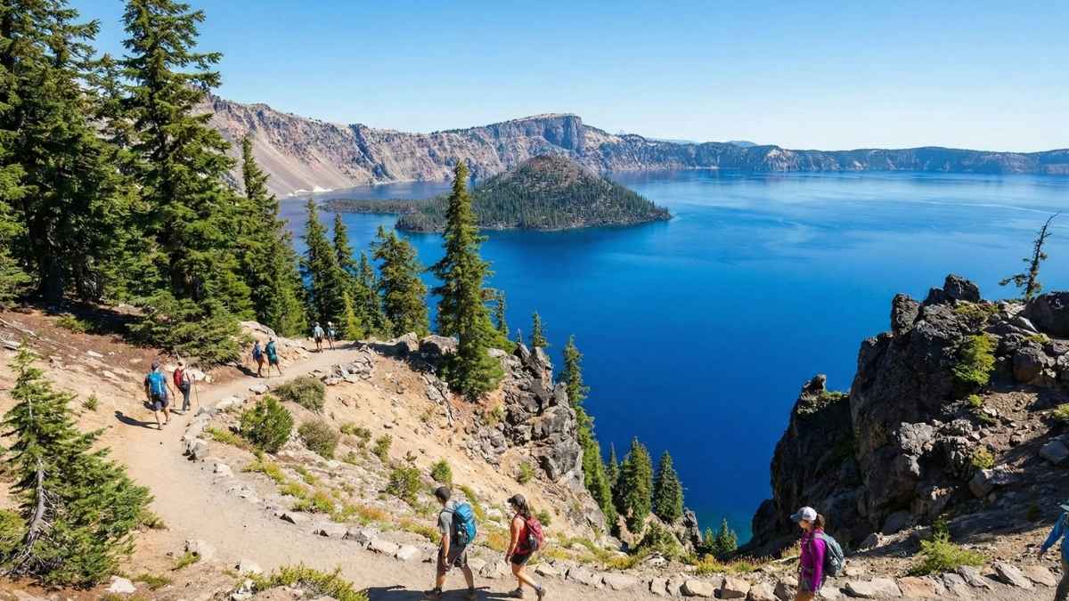
Cleetwood Cove isn’t just a trail — it’s the only legal way to reach the shoreline of Crater Lake. Every step down this steep, switchback-heavy path feels like a descent into another world, where the water turns impossibly blue and the air gets quieter with each bend. For decades, this trail has been the gateway to swimming, boat tours, and that rare feeling of standing face-to-face with the deepest lake in the U.S.
What makes this closure hit harder is what’s being lost during the shutdown. Once the trail closes for long-term rehabilitation, there will be no access to the lake itself for years. No boat tours. No cold-water swims. No photos from lake level. Even if it eventually reopens, the experience as we know it is ending in 2026.
Many visitors don’t realize how physically demanding this trail already is — and that’s part of the reason for the closure. Erosion, rockfall risk, and aging infrastructure have finally caught up. Seeing it before the gates close isn’t about ticking a box; it’s about experiencing Crater Lake in its most intimate form, something future visitors may not get for a very long time.
Good to know
- Best months: July to September
- Difficulty: Strenuous (steep elevation gain on return)
- Trail length: ~2.2 miles round trip
- Why it’s closing: Multi-year rehabilitation & safety upgrades
- What you’ll miss after closure: Lake access, swimming, boat tours
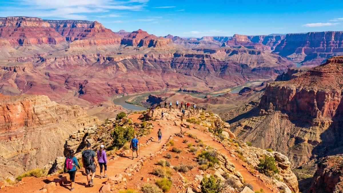
2. North Kaibab Trail — Grand Canyon National Park
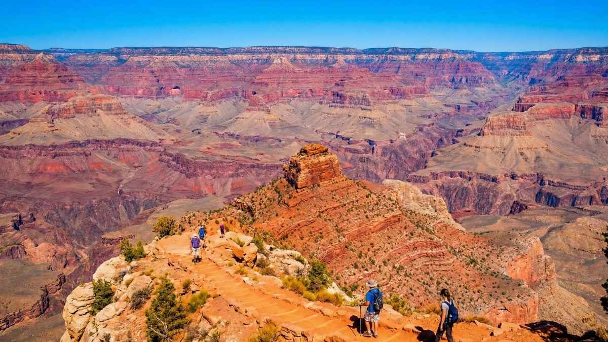
The North Kaibab Trail has always felt different from other Grand Canyon routes. Less crowded. Wilder. More remote. Dropping from the forested North Rim into the inner canyon, it delivers one of the most dramatic vertical journeys in the entire park. For serious hikers, it’s long been the preferred way to truly understand the canyon’s scale.
Fire damage and environmental stress have changed everything. What was once a reliable corridor into the canyon is now facing indefinite closure, with current plans effectively ending public access beyond 2026. This isn’t just a seasonal pause — it’s a major shift in how people experience the North Rim side of the canyon.
Losing this trail means losing one of the quietest and most immersive canyon descents. Fewer day hikers ever reached this side, which made it feel raw and untouched. When access disappears, so does a whole perspective of the Grand Canyon that guidebooks rarely emphasize but seasoned hikers swear by.
Good to know
- Best months: June to early October (weather dependent)
- Difficulty: Very strenuous
- Trail length: Up to 28 miles round trip (to river and back)
- Why it’s closing: Fire damage, infrastructure instability
- What’s at risk: Long-term or permanent access loss
3. Plateau Point Trail — Grand Canyon National Park
Plateau Point doesn’t shout for attention, and that’s exactly why it’s special. This short spur off the Bright Angel Trail leads to a quiet overlook where the Colorado River slides silently below. No crowds. No guardrails. Just space, silence, and a view that feels earned rather than staged.
The trail has been repeatedly damaged by landslides and structural failures, and 2026 marks the final cutoff before permanent decommissioning. Once it closes, hikers will still pass nearby — but this viewpoint will be gone. That subtle detour that rewarded curiosity will simply disappear from maps.
What makes this loss sting is how rare places like Plateau Point are becoming. It wasn’t flashy or famous, but it delivered one of the most peaceful inner-canyon moments available on a maintained trail. Once it’s closed, the experience doesn’t shift elsewhere — it’s just gone.
Good to know
- Best months: March to May, September to November
- Difficulty: Moderate (but long approach)
- Trail length: ~12 miles round trip from South Rim
- Why it’s closing: Chronic landslide damage
- What you’ll miss: One of the canyon’s quietest river views
4. Laurel Falls Trail — Great Smoky Mountains National Park
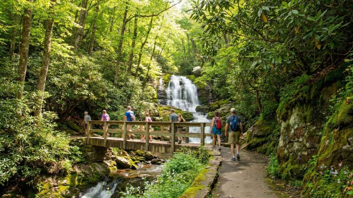
Laurel Falls has long been one of the Smokies’ most accessible waterfall hikes, drawing families, casual walkers, and first-time park visitors. The paved path, shaded forest, and steady sound of rushing water made it feel welcoming — almost effortless — compared to the park’s more rugged routes.
By 2026, the trail as people know it will no longer exist. Major reconstruction and safety redesigns mean extended closure, and when it eventually reopens, the experience will be fundamentally different. Wider paths, altered viewpoints, and stricter access controls will change the trail’s original charm.
For many visitors, Laurel Falls wasn’t about adventure — it was about connection. Losing it during this closure window means losing a shared memory space that introduced countless people to hiking. Seeing it before construction begins is a chance to experience one of the Smokies’ most iconic short walks in its original form.
Good to know
- Best months: April to October
- Difficulty: Easy to moderate
- Trail length: ~2.6 miles round trip
- Why it’s closing: Major safety and infrastructure overhaul
- Expect after reopening: Heavier regulation, redesigned trail
5. River Trail (Inner Canyon Segment) — Grand Canyon National Park
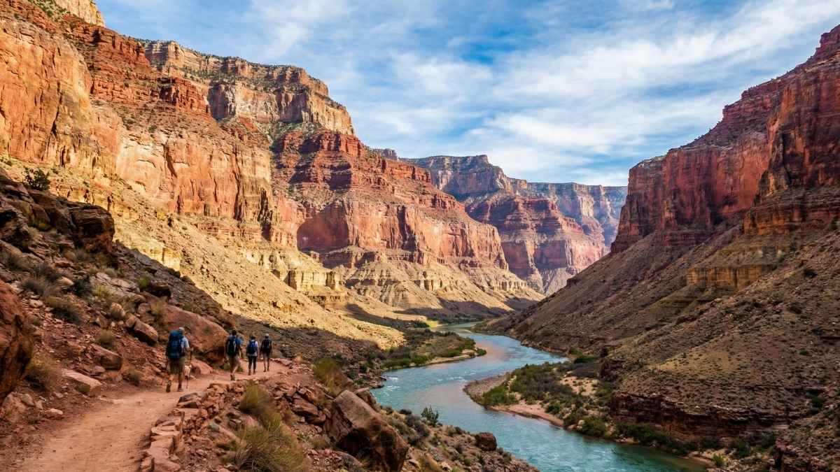
The inner canyon River Trail offered something rare: a relatively gentle walk deep inside the Grand Canyon. Running close to the Colorado River, it allowed hikers to experience the canyon from below without committing to extreme elevation changes. It felt slow, immersive, and surprisingly intimate.
Environmental wear, flooding damage, and maintenance challenges have pushed this trail toward long-term closure beyond 2026. Once access ends, there won’t be another easy inner-canyon alternative that offers the same river-level experience.
This trail mattered because it changed the rhythm of a canyon visit. Instead of conquering heights, you followed the river’s pace. Losing it means losing a perspective that balanced the Grand Canyon’s intensity with calm — something that doesn’t get replaced by harder routes.
Good to know
- Best months: October to April
- Difficulty: Moderate
- Trail length: Varies by access point
- Why it’s closing: Flood damage and maintenance limits
- What disappears: One of the few river-level hiking experiences
6. Silver Bridge Trail Connector — Grand Canyon National Park
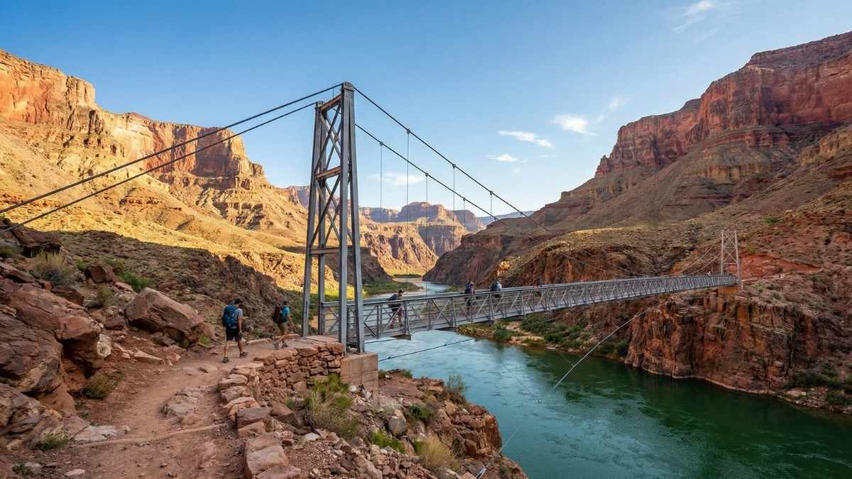
The Silver Bridge connector rarely gets top billing, but its importance becomes obvious the moment you step onto it. This short trail segment links major inner-canyon routes and serves as a critical crossing point over the Colorado River. It’s functional, yes — but it also offers a striking, close-up view of the river most visitors only see from far above.
By 2026, structural concerns and long-term maintenance challenges are expected to end public access permanently. Once closed, hikers won’t just lose a bridge — they’ll lose a key piece of connectivity that made certain loop hikes and itineraries possible without rerouting miles out of the way.
What makes this closure especially frustrating is how quietly it arrives. Many people won’t realize it’s gone until they try to plan a familiar route and find the map no longer works the way it used to. Trails don’t always vanish with drama; sometimes they disappear by subtraction.
Good to know
- Best months: October to April
- Difficulty: Moderate
- Trail length: Short connector, but part of longer hikes
- Why it’s closing: Structural and maintenance limitations
- Why it matters: Key inner-canyon river crossing
7. Congaree Boardwalk Trail Sections — Congaree National Park
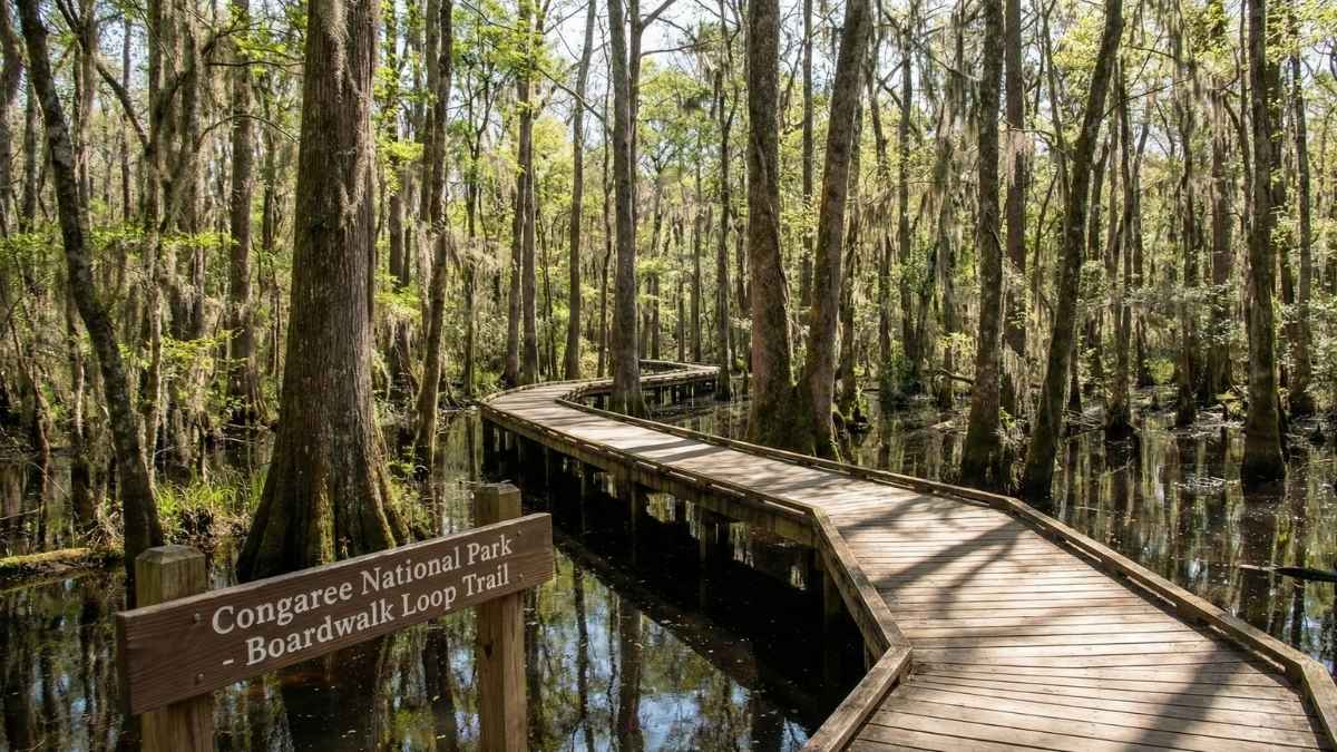
Congaree’s boardwalk trails feel unlike any other national park experience. Elevated paths wind through ancient floodplain forest, where cypress knees rise from dark water, and the air hangs heavy with humidity and birdsong. It’s quiet, immersive, and strangely hypnotic.
Ongoing flood damage and rot have already forced rolling closures, but by 2026, several original boardwalk sections will be removed or permanently rerouted. Even if replacement paths appear, the original alignment — and the way it moved through the forest — will be gone.
This matters because Congaree is a park defined by subtlety. There are no big vistas to replace what’s lost. When a boardwalk disappears, so does a very specific way of moving through the ecosystem, one that lets visitors observe without disturbing the land beneath their feet.
Good to know
- Best months: October to April
- Difficulty: Easy
- Trail length: Varies by section
- Why it’s closing: Flood damage and wood deterioration
- What changes: Original boardwalk paths removed or relocated
8. Hastain & Discovery Trail Portions — Santa Monica Mountains National Recreation Area
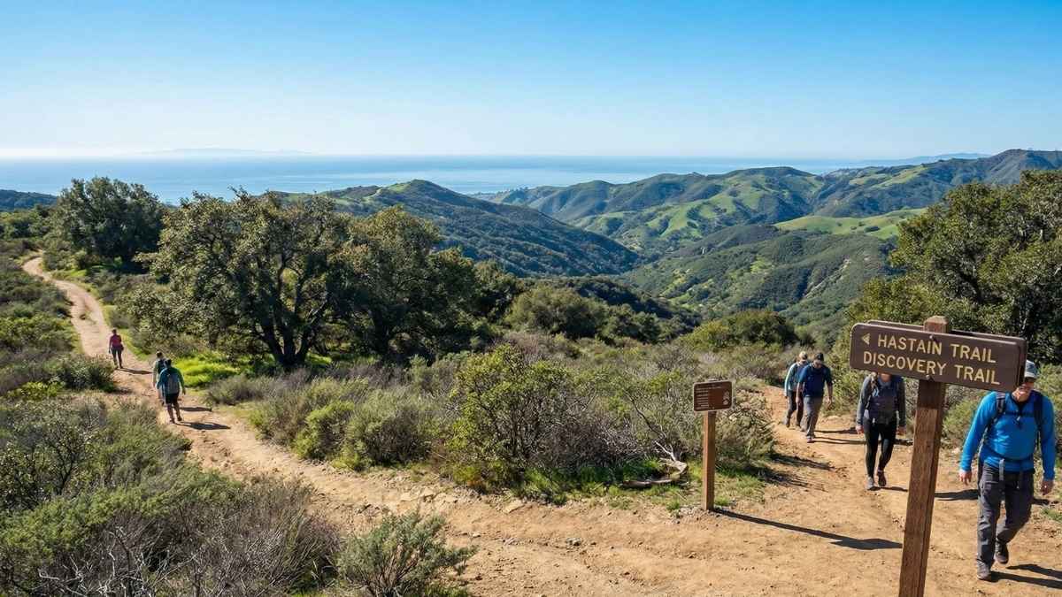
These trails offer something rare: a wild-feeling hike minutes from a major city. Rolling hills, oak woodlands, and canyon views stretch out just beyond Los Angeles, making these routes favorites for locals who want nature without the long drive.
Storm damage and erosion have pushed certain sections toward permanent closure after repeated repairs failed. By 2026, access to some connecting segments will be cut off entirely, breaking continuous loops that hikers have relied on for years.
What’s lost here isn’t just scenery — it’s accessibility. These trails were gateways for people who couldn’t easily reach remote national parks. When urban-adjacent trails disappear, the ripple effect quietly reduces who gets to experience public land at all.
Good to know
- Best months: November to April
- Difficulty: Moderate
- Trail length: Varies by loop
- Why it’s closing: Repeated storm and erosion damage
- Impact: Loss of key urban-access hiking routes
9. Yosemite Backcountry Trail Segments — Yosemite National Park
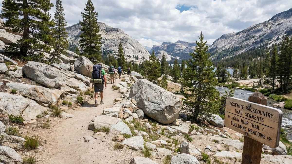
Yosemite’s closures don’t arrive all at once. Instead, they happen piece by piece — a footbridge removed here, a backcountry segment quietly retired there. By 2026, several lesser-known trail sections will be fully decommissioned, never returning to official maps.
These aren’t the famous routes crowded with permits and cameras. They’re the connectors, alternates, and exploratory paths that allowed hikers to escape the main corridors and stitch together creative backcountry journeys. Once gone, those possibilities shrink.
What makes this loss feel heavy is Yosemite’s scale. When even a small trail disappears here, it alters how people move through the landscape. Fewer options mean more pressure on remaining routes — and fewer chances to experience Yosemite on your own terms.
Good to know
- Best months: July to September
- Difficulty: Varies
- Trail length: Varies by segment
- Why it’s closing: Environmental restoration and maintenance limits
- What’s lost: Backcountry flexibility and lesser-known routes