The 15 Best National Park Hikes I’ve Ever Done (50 Parks Later)

America’s national parks hold some of the finest hiking on the planet — desert arches, active volcanoes, actual glaciers — and I’ve now walked trails in 50 of them.
Every hike on this list is one I’ve done myself. If I haven’t stood on the trail, it isn’t here — which is why you won’t find Rocky Mountain on this list, even though it deserves a spot.
These 15 cover every terrain type I’ve encountered across the system: waterfalls, craters, canyons, ice, and underground caves. Some are bucket-list-level hard. A few are genuinely accessible to almost anyone.
I’ve included honest warnings, permit logistics, and the timing details that guidebooks tend to skip. Read through, pick your trail, and start planning.
Quick Tips Before You Start
Check Permits Early
Angels Landing and Half Dome both use seasonal lotteries at recreation.gov — enter months before your trip, not weeks.
Start at Dawn
For desert hikes like Delicate Arch and Lost Mine Trail, an early start beats the heat and the crowds in one move.
Carry More Water Than You Think
Seasonal water refill stations at Bright Angel can be closed — verify at nps.gov/grca and pack backup regardless.
Rent Crampons On-Site
Skyline Trail at Rainier and Root Glacier in Wrangell-St. Elias both warrant traction gear — you can rent near both trailheads.
Download Offline Maps
Cell signal disappears fast in Wrangell-St. Elias and the Grand Canyon backcountry — download AllTrails maps before you leave the car.
1. Mist Trail, Yosemite National Park
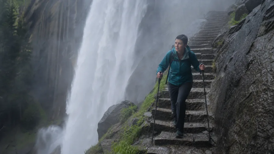
Every hike after this one gets measured against it. The Mist Trail to Nevada Falls is roughly 5 to 6 miles round trip, and in spring the falls are roaring so hard you feel the spray on your face before you see the water. The stone steps near Vernal Falls are perpetually slick from the mist – grippy shoes or trekking poles are not a nice-to-have in April and May, they’re the difference between a great day and a bad one.
If you win the Half Dome permit lottery at recreation.gov, the extension stretches the whole day to 16 miles round trip and ends on a cable-assisted summit with serious exposure. If heights give you pause, stop at Nevada Falls and feel zero guilt about it.
Just the Mist Trail alone is already one of the finest hikes in the national park system. The Half Dome permit is the bonus, not the reason to go.
| Trail & Park | Distance (RT unless noted) | Difficulty | Permit Required | Best Season |
|---|---|---|---|---|
| Mist Trail, Yosemite | 5–6 mi (16 mi w/ Half Dome) | Strenuous | Half Dome only (lottery) | Apr–Jun |
| Skyline Trail, Mt. Rainier | 5.5 mi loop | Moderate–Strenuous | No | Aug–Sep |
| Sliding Sands, Haleakalā | ~11 mi (one-way strategy recommended) | Strenuous | No (day hike) | Apr–Oct |
| Angels Landing, Zion | 4.5 mi | Strenuous | Yes (seasonal lottery) | Mar–May, Sep–Nov |
| Bright Angel, Grand Canyon | Up to 12.2 mi RT | Moderate–Strenuous | No (day hike) | Mar–May, Sep–Nov |
| Delicate Arch, Arches | 3 mi | Moderate | No | Mar–May, Sep–Nov |
| Queens Garden, Bryce Canyon | 1.8–2.9 mi | Easy–Moderate | No | Apr–Oct |
| Lassen Peak, Lassen Volcanic | 5 mi | Strenuous | No | Jul–Oct |
| Cascade Canyon, Grand Teton | ~10 mi | Moderate | No | Jun–Sep |
| Upper Geyser Basin, Yellowstone | 0.5–3+ mi | Easy | No | Apr–Oct |
| Precipice Trail, Acadia | 1.6 mi | Very Strenuous | No (seasonal closure possible) | Jun–Aug |
| Lost Mine Trail, Big Bend | 4.8 mi | Moderate | No | Oct–Apr |
| Rainbow Falls, Great Smoky Mtns | 5.4 mi | Moderate | Check nps.gov/grsm | Apr–Jun, Sep–Nov |
| Root Glacier, Wrangell-St. Elias | ~4 mi | Moderate | No | Jun–Sep |
| Natural Entrance, Carlsbad Caverns | 1.2 mi one way | Moderate | Entry fee (check nps.gov/cave) | Year-round |
2. Skyline Trail, Mount Rainier National Park
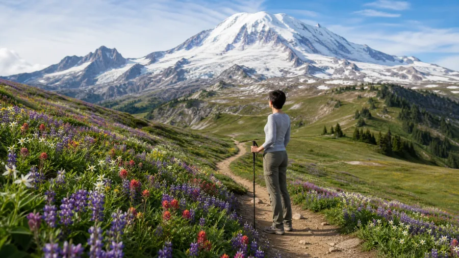
Yosemite sets a high bar, and then Mount Rainier quietly clears it. The Skyline Trail is a 5.5-mile loop from the Paradise trailhead with 1,700 feet of elevation gain – modest numbers that do not prepare you for what you actually see up there.
On a clear day, Mount Adams and Mount St. Helens sit on the horizon like a bonus nobody told you about. The wildflower meadows in late July are genuinely worth the trip on their own.
Snow is the catch. It lingers well into July, and traction devices are sometimes necessary even on the main loop. Check current conditions at nps.gov/mora before you drive to the trailhead – I’ve watched hikers turn around in the parking lot because they didn’t bother.
Paradise is one of the busiest trailheads in the park, so an early weekday start keeps the experience from feeling crowded. It’s one of the most rewarding short alpine hikes in the Pacific Northwest, worth every step even if Rainier’s summit disappears into cloud halfway through.
💡 Tip: Crampons or microspikes can be rented in the town of Ashford, about 6 miles from the Nisqually entrance, if you don't own a pair.
3. Sliding Sands Trail, Haleakalā National Park
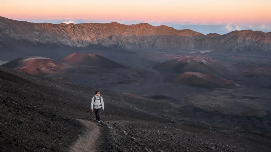
Mount Rainier is all jagged peaks and green meadows – Haleakala is the opposite of that in every possible way, and that contrast is exactly the point.
The trail starts at 10,023 feet, and the thin air announces itself within the first ten minutes. The opening descent into the crater feels deceptively gentle. It isn’t. The steep climb back out at the end will recalibrate your confidence fast.
Skip the full 11-mile out-and-back. The National Park Service created a designated hitchhike pull-out at the trailhead for hikers who want a one-way descent – this is a park-sanctioned strategy, not improvised roadside hitchhiking. You descend in, someone picks you up at the pull-out, and you’re done. It transforms the logistics entirely.
Inside the crater, red cinder cones rise from a floor that shifts between rust, charcoal, and silver-grey. The silence is total. Calling it Martian is not an exaggeration – it genuinely feels like another planet.
Start at dawn for the best light in the crater and to dodge midday heat. The trail is open year-round but most comfortable between April and October.
How Hard Are These Hikes, Really?
Placed on a low-to-high effort scale using distance, gain, and exposure
- Queens Garden, Bryce Canyon: 1.8 mi, gentle descent — the easiest on the list
- Natural Entrance, Carlsbad Caverns: 1.2 mi one way, steep but short — elevator out
- Delicate Arch, Arches: 3 mi, 480 ft gain — heat and zero shade are the real challenge
- Angels Landing, Zion: 4.5 mi, 1,400 ft gain — chains, exposure, permit required
- Lassen Peak, Lassen Volcanic: 5 mi, 2,000+ ft gain — relentless grade, thin air, snow into summer
4. Angels Landing, Zion National Park
After the crater’s eerie quiet, you might want something that gets your heart rate up in a completely different way. Angels Landing does that.
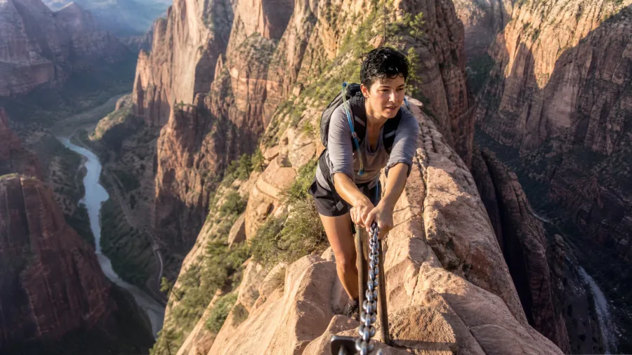
It’s 4.5 miles round trip with 1,400 feet of gain. The final chains section is a narrow ridgeline with sheer drop-offs on both sides – the chains are literally the only thing between you and the void. If exposed heights make you freeze, this hike is genuinely not suitable for you. That’s not a fitness question. No amount of cardio changes what your body does when it panics on a six-inch ledge with nothing below.
A permit is required through a seasonal lottery at recreation.gov – check there for current entry windows, dates, and fees, because they’ve changed before and will again.
The views from the summit down into Zion Canyon are among the finest anywhere in Utah. If you get the permit and the nerve, it’s worth every anxious step.
5. Bright Angel Trail, Grand Canyon National Park
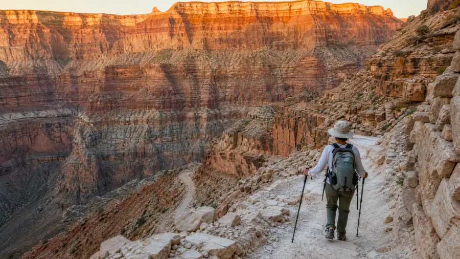
You’re two miles down Bright Angel, the canyon walls are glowing, and the river seems close enough to touch. This is exactly where the trail starts to win.
The turnaround ladder runs like this: first rest house at 1.5 miles, second at 3 miles, Indian Garden at 4.6 miles, Plateau Point at 6.1 miles, then the river. For most day hikers, Plateau Point is the real ceiling. Water refill stations exist but are seasonal – confirm availability at nps.gov/grca before you count on them.
The descent feels easy. That’s the trap. The climb back out, in heat, through every geological layer you enjoyed on the way down, is where the canyon collects its debt. Going to the river and back in a single day is not recommended for most hikers regardless of fitness – heat and elevation on the return combine in ways willpower cannot override. Get to Indian Garden and you’ll already understand why people make this trip again and again.
⚠️ COMMON MISTAKE
The Canyon Heat Trap
The biggest mistake on Bright Angel and Delicate Arch is starting too late in the morning. By 10 AM in June through August, midday desert sun turns both trails into genuine hazards. Set your alarm — on these hikes, early is not a preference, it's the plan.
6. Delicate Arch Hike, Arches National Park
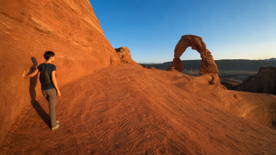
Delicate Arch is the arch on Utah license plates, one of the most recognized natural landmarks in the entire national park system – and also one of the most deceptively exposed hikes on this list.
It’s only 3 miles round trip with 480 feet of gain, which sounds easy until you’re halfway across a wide-open slickrock face with the sun overhead and nowhere to hide. There is zero shade on that section. Carry more water than feels necessary. Before 8 AM or after 5 PM in summer isn’t a preference – midday heat on open slickrock is a genuine hazard, and no permit requirement means the only logistics decision you have to make is when to show up.
The finish is worth every bit of that planning. The trail opens into a natural stone amphitheater and the arch stands completely alone against open sky. The final ledge section is wide enough that most hikers handle it without any real trouble – and the view stops you cold every time.
7. Queens Garden Trail, Bryce Canyon National Park
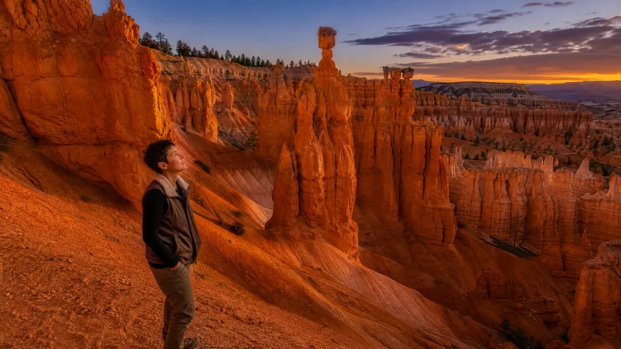
After two back-to-back hikes with serious sun exposure and no shade, you’re probably asking if there’s a trail that lets you actually enjoy the scenery instead of surviving it – and Queens Garden is exactly that.
It’s 1.8 miles round trip from Sunrise Point, winding gently down into the amphitheater among the hoodoos. The easiest trail on this entire list, and a genuine highlight. Link it with the Navajo Loop and the circuit stretches to roughly 2.9 miles, pulling in Thor’s Hammer and the Wall Street narrows canyon – a worthwhile add-on for anyone who wants a fuller morning without committing to a hard day.
Keep an eye out for the Queen Victoria formation as you move through the basin – it’s unmistakable once you know to look for it. And plan to be on the trail at sunrise or sunset. The orange and red colors in the hoodoos deepen dramatically in low-angle light, and the amphitheater at those hours feels completely different from midday.
💡 Tip: Sunrise Point has a small parking area that fills fast. Park at the main visitor center and walk the rim trail 10 minutes south to the trailhead.
8. Lassen Peak, Lassen Volcanic National Park
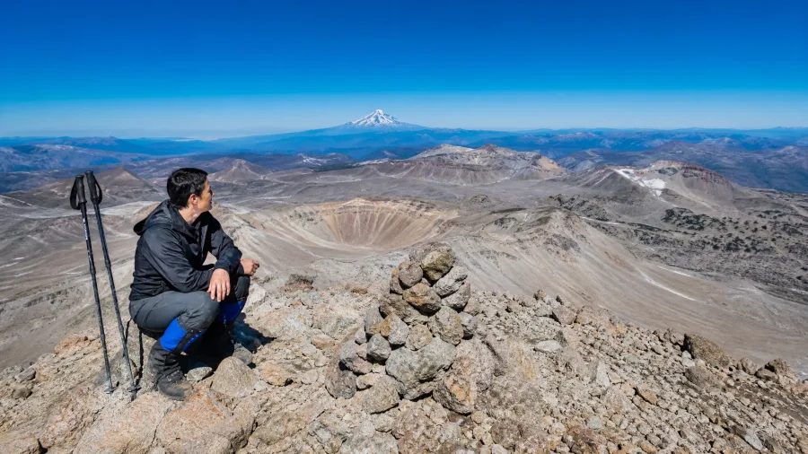
Lassen Peak stands among the rare spots within the contiguous United States where a hiker can actually reach the top of a dormant volcano, and it earns that distinction with every step.
Five miles round trip sounds manageable – and that’s exactly what fools people. The trail climbs more than 2,000 feet, steep throughout, with no real section where the grade lets you recover. Most hikers take significantly longer than they budgeted, especially anyone coming in from lower elevations.
The seasonal window is the other thing that catches people off guard. Snow blocks the trail well into summer and it typically doesn’t open until July. Verify the current open date at nps.gov/lavo before you build any travel plans around it – showing up a week early is a real possibility if you don’t check.
From the summit, the volcanic landscape spreads out in every direction and Mount Shasta appears clearly on a good day. The trail surface itself tells the story of what this park is – loose, volcanic, unlike anything underfoot on a standard mountain hike. Turn around without shame if the altitude is hitting hard. There’s no version of this where pushing through altitude sickness ends well.
Worth the Permit Fight vs. Just Show Up
Permit Required
- Angels Landing — seasonal lottery at recreation.gov
- Half Dome cables section — separate lottery, apply early
- Rainbow Falls trailhead may need timed-entry — check nps.gov/grsm
- Zion timed entry — verify at nps.gov/zion before booking
Just Show Up
- Mist Trail to Nevada Falls — no permit, just go
- Delicate Arch — no permit, timing is everything
- Queens Garden, Bryce Canyon — walk in any day
- Upper Geyser Basin, Yellowstone — free access to boardwalks
- Root Glacier, Wrangell-St. Elias — no permit for day hike
9. Cascade Canyon, Grand Teton National Park
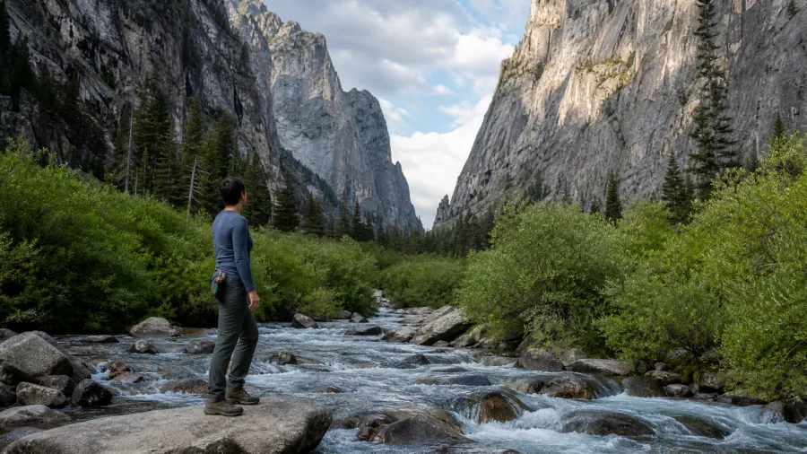
From a volcanic summit with no trees in sight, the jump to Cascade Canyon feels like landing on a different planet – and the hike starts before you even set foot on dirt.
A boat shuttle across Jenny Lake drops you at the west shore dock, and the canyon opens up almost immediately after. Hidden Falls sits about 0.5 miles past the dock, Inspiration Point a short climb after that. For anyone who wants a lighter day, those two stops alone are worth the boat fare – check current rates at nps.gov/grte. Push deeper and the full out-and-back reaches roughly 10 miles, a clear mountain stream running the entire length of the canyon floor between cliff walls that rise hundreds of feet on both sides.
Moose and bear sightings are genuinely common here. Make noise on the trail, especially in the dense willows near the stream, and keep bear spray where you can actually reach it.
10. Upper Geyser Basin Walk, Yellowstone National Park
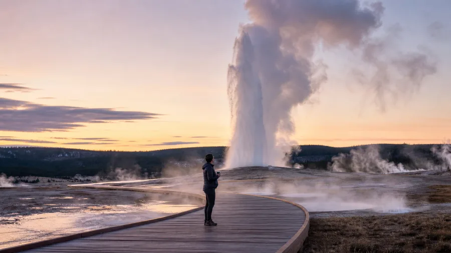
After a hike that demands a boat fare, bear spray, and ten miles of canyon, the Upper Geyser Basin feels almost unfair – it’s mostly flat boardwalk, and it might be the most spectacular walking in any national park in the country.
This is home to Old Faithful and the world’s largest concentration of geysers. Boardwalk routes range from a quick 0.5-mile loop around Old Faithful to more than 3 miles exploring the full basin, with hot springs, steam vents, and geysers of every size spread across the whole thing. It is not a single-attraction stop.
Old Faithful erupts roughly every 90 minutes on average. Build in enough time to catch multiple eruptions in different parts of the basin, because each geyser runs on its own schedule and has its own personality – sitting by a smaller geyser as it builds and fires is a completely different experience from watching Old Faithful from the crowded viewing area.
Go in the morning or late afternoon. Steam columns in low light are dramatically more striking than at midday, and foot traffic is noticeably lighter at both ends of the day. The early visit especially – steam rising in cool air, almost nobody on the boardwalk – is one of those hours in a national park you don’t forget easily.
Upper Geyser Basin — At a Glance
📏 Route Range
0.5 mi loop (Old Faithful only) to 3+ mi (full basin)
⛰️ Elevation Gain
Negligible — paved and boardwalk throughout
🎫 Permit
None — free entry with park pass
⏱️ Old Faithful Prediction
Next eruption time posted at the visitor center — accurate within ~10 min
🕗 Shoulder Season Note
Some boardwalk sections close in winter; snowcoach or ski-in access only Nov–Apr
Don't miss this
Geyser Hill — just across the footbridge from Old Faithful — holds Beehive, Anemone, and Lion geysers, all with their own eruption windows. The NPS Yellowstone app lists current predictions for the major ones; check it before you leave the parking lot.
11. Precipice Trail, Acadia National Park
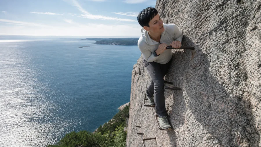
After all the long desert slogs and alpine switchbacks on this list, here is the one that goes almost straight up a cliff face. Precipice Trail in Acadia is 1.6 miles round trip with roughly 1,000 feet of gain, and calling it a trail is a stretch – iron rungs are bolted directly into the rock, narrow ledges demand hands and feet, and the exposure is real from about halfway up.
If heights give you any hesitation at all, this is not the place to find out where your limit is. Skip it entirely in wet weather; those rungs become genuinely dangerous when slick, not just uncomfortable. Also check nps.gov/acad before you drive out – the trail closes during peregrine falcon nesting season, typically in spring, and the closure is strictly enforced.
The payoff is Atlantic Ocean views from an open summit that I would stack against anything else on the East Coast. It is short enough to finish in a half-day and still make it to Bar Harbor for lobster rolls by lunch.
12. Lost Mine Trail, Big Bend National Park
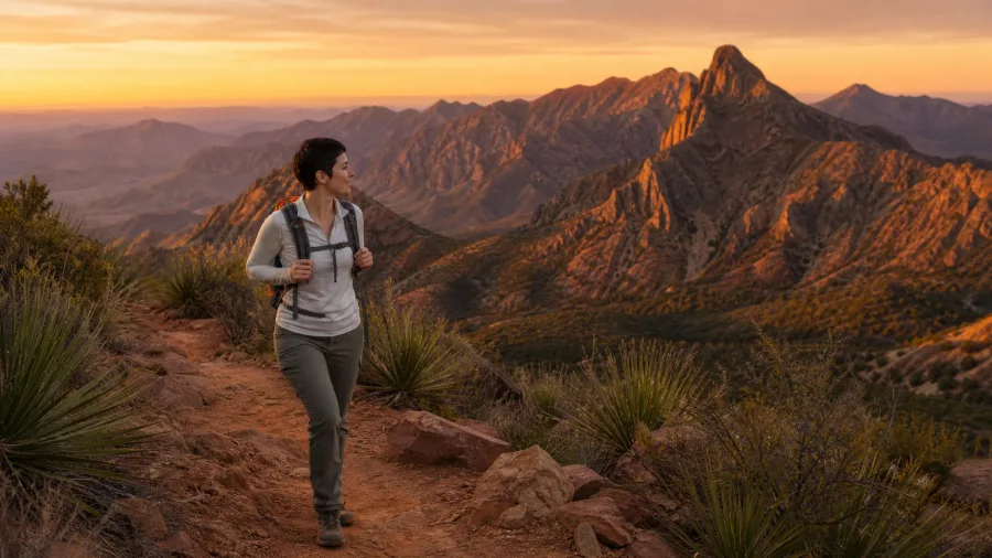
Picture the moment you pull into Chisos Basin just before dawn, the desert still dark around you, those mountain peaks rising out of nothing like an island. That is exactly when you want to be lacing up for Lost Mine Trail – because the light that follows is the whole point.
The hike itself is 4.8 miles round trip with 1,100 feet of gain: a steady, consistent climb with nothing technical. Any hiker comfortable with moderate distance and some desert exposure can do this one. The catch is parking – the Chisos Basin lot fills fast in peak season, and arriving at or before sunrise is not a suggestion, it is the logistics plan.
Sunrise spills across the Chisos peaks and pours down into the valley in a way that genuinely changes the hike. Sunset from the upper section hits the same way. Time one end of your out-and-back around low-angle light and this trail delivers well above its difficulty rating.
It is the perfect first day in Big Bend – the kind of hike that shows you the park’s scale and character before you have even unpacked properly.
13. Rainbow Falls Trail, Great Smoky Mountains
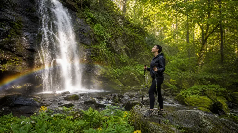
Every park on this list has its own atmosphere, but none of them feel quite like the Smokies. You notice it within the first quarter mile of Rainbow Falls Trail – old-growth forest closing in around you, moss thick on every boulder, wildflowers crowding the path in season. It is a completely different sensory world from the desert and alpine entries earlier on this list.
The trail runs 5.4 miles round trip with 1,200 feet of gain, and the reward at the top is an 80-foot waterfall that, in morning sunlight, produces a genuine rainbow in the mist. That effect requires an early start – a dawn departure is necessary, not optional, if catching it is your goal. It is also when the forest is quietest and the light through the canopy is at its best.
Two practical things to sort before you go. First, check nps.gov/grsm for timed-entry parking reservation requirements at the trailhead – these can apply in peak season and a wasted drive here is a long wasted drive. Second, this trail is moderately challenging in dry conditions and becomes genuinely slippery after rain.
The falls are more dramatic when water is high after a rain, but the wet roots and rocks demand your full attention on the way up. Trekking poles help here more than on almost any other trail on this list.
The falls at the end feel like something the forest has been building toward the whole time. It is exactly what people mean when they say the Smokies are worth the trip.
💡 Tip: The rainbow mist effect is strongest between 9 and 11 AM in spring and early summer when the sun angle is right. Plan your start time backward from that window.
What to Expect on a Two-Week National Park Hiking Trip
14. Root Glacier Trail, Wrangell-St. Elias National Park
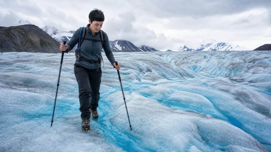
The moment you step off the dirt and onto the ice – blue-white, groaning faintly in the afternoon heat – is when Root Glacier Trail stops being a hike and becomes something else entirely. Nothing else on this list prepares you for that transition.
The approach walks through Kennecott Mines National Historic Landmark, a copper mining ghost town that is genuinely worth slowing down for before you reach the glacier. The full out-and-back is roughly 4 miles. Crampons are strongly recommended on the ice – skipping them is a real safety mistake, not just a comfort issue – and you can rent them right in Kennecott before you set out.
On the glacier itself, you are walking on sheer blue-white ice with meltwater pools carving channels around you and open crevasses visible in the distance. It feels like another planet. The best window is June through September, when the glacier is accessible and the weather is most cooperative. Plan accordingly – Wrangell-St. Elias is remote enough that logistics need to be sorted well in advance.
15. Natural Entrance Trail, Carlsbad Caverns National Park
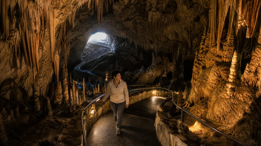
Every other hike on this list goes up. This one goes down – 750 feet down, in a steep spiral, from full desert daylight into near-total darkness.
The Natural Entrance Trail is 1.2 miles one way, and the descent into Carlsbad Caverns is one of the strangest and most compelling things in the national park system. Stalactites, stalagmites, and flowstone formations crowd in on both sides as the path winds lower. By the time you reach the Big Room – one of the largest underground cave chambers in North America – the surface feels like a different world.
an elevator takes you back up. This is genuinely a one-way experience with no penalty for skipping the climb out. Bring a light layer no matter what the thermometer says outside – the cavern holds at around 56 degrees year-round, which also makes this the rare hike that works beautifully on a scorching desert afternoon when everything else on this list would be miserable.
Best Time of Year for Snow, Heat, and Crowds
The single biggest planning mistake I see is booking a trip without checking whether the trail is actually open. Snow, heat, and crowds each have their own window, and getting the timing wrong can mean a locked gate, a dangerous midday climb, or a trailhead so packed it barely feels worth it.
Snow-dependent trails have real seasonal limits. The Skyline Trail at Rainier is most reliable August through September – if you’re visiting in June or early July, check conditions first, because traction devices might be mandatory and sections can be impassable. Lassen Peak typically opens in July and can still carry snow past the Fourth of July; always verify current status at nps.gov/lavo before you commit to a date. Sliding Sands at Haleakala is accessible year-round, but April through October is the comfortable window.
Desert heat is a different kind of problem – it’s genuinely dangerous, not just unpleasant. Delicate Arch and Bright Angel should not be hiked at midday from June through August, full stop. Grand Canyon rangers specifically advise against going below the rim during summer midday hours, and I take that seriously. Early morning or late afternoon, every time.
Yosemite and Zion now run timed-entry and reservation systems during peak summer. Check nps.gov for both parks well before you book flights, because showing up without a reservation can mean a locked entrance gate and a wasted trip.
Late September and October are the most underrated window across the desert Southwest and the Rockies. Temperatures drop, crowds thin out, and the low-angle fall light makes every canyon and hoodoo look extraordinary. If your schedule has any flexibility at all, aim for that stretch.
Frequently Asked Questions
Do I need a permit for the Mist Trail in Yosemite?
No permit is required for the Mist Trail itself up to Nevada Falls. The permit requirement applies only to the cables section of Half Dome, which requires a lottery application at recreation.gov. The Mist Trail to Nevada Falls is a walk-up hike — just arrive early in spring and summer to secure a parking spot in Yosemite Valley.
How hard is the Angels Landing hike really, compared to other trails?
The mileage and elevation gain are moderate by national park standards — 4.5 miles and 1,400 feet. What makes Angels Landing genuinely difficult is the chains section: a narrow ridge with sheer drop-offs on both sides where chains are the only handhold. Hikers who are comfortable with heights handle it fine; those who freeze on exposed ridges should skip it entirely, regardless of fitness level.
What should I wear and bring to Root Glacier?
Crampons are the non-negotiable item — rent them in Kennecott before the hike. Dress in layers, as glacier temperatures are cooler than the surrounding valley even in summer. Waterproof footwear handles the meltwater puddles on the ice surface. Sunglasses with UV protection are essential; ice reflects sunlight intensely and eye fatigue sets in faster than you’d expect.
Is the Carlsbad Caverns Natural Entrance Trail suitable for kids?
Yes, with appropriate expectations. The path is paved and the 1.2-mile descent is doable for most kids who can handle a sustained downhill walk in near-darkness. The elevator removes the difficult return climb entirely. Bring a light jacket — the cavern sits at around 56°F year-round — and keep young children close on the narrow sections near the entrance where the drop-off is steep.
Which of these 15 trails is best for a first-time national park hiker?
Queens Garden at Bryce Canyon is the easiest entry on the list and an outstanding first experience — 1.8 miles, gentle, and immediately surrounded by remarkable hoodoo scenery. Lost Mine Trail at Big Bend is the best step up from there: moderate distance, no technical sections, and payoffs that scale with the time of day you choose to hike.
Can I do Sliding Sands Trail without hitchhiking?
Yes — the full out-and-back is roughly 11 miles, and plenty of hikers complete it. The challenge is the steep final climb back out of the crater at over 10,000 feet elevation, which most people find significantly harder than expected. The NPS-created hitchhike pull-out at the trailhead is a park-sanctioned alternative for a one-way descent, not a workaround. If you do the full out-and-back, start at or before dawn and carry more water than you think you need.
Matching These 15 Trails to How You Actually Hike
If you’re new to national park hiking, start with Queens Garden at Bryce Canyon — low stakes, immediate payoff, and the perfect way to fall in love with this kind of travel before committing to anything harder.
If you want the adrenaline hike that people talk about for years, book the Angels Landing permit the moment the lottery opens. Nothing else on this list puts you on a ridge like that.
If you’re willing to travel to Alaska, Root Glacier in Wrangell-St. Elias is the one that no other park in the lower 48 can replicate. Walking on ice past open crevasses is genuinely unlike anything else in the national park system.
You’ve read the list. Pick one trail, check the permit status, and book the trip.
Start With the Hike Table
Scroll back up to the at-a-glance table to find your trail by difficulty and season, then head straight to nps.gov to check current permits and conditions before anything else.