Why Some Beaches Are Closed to Tourists Without Explanation

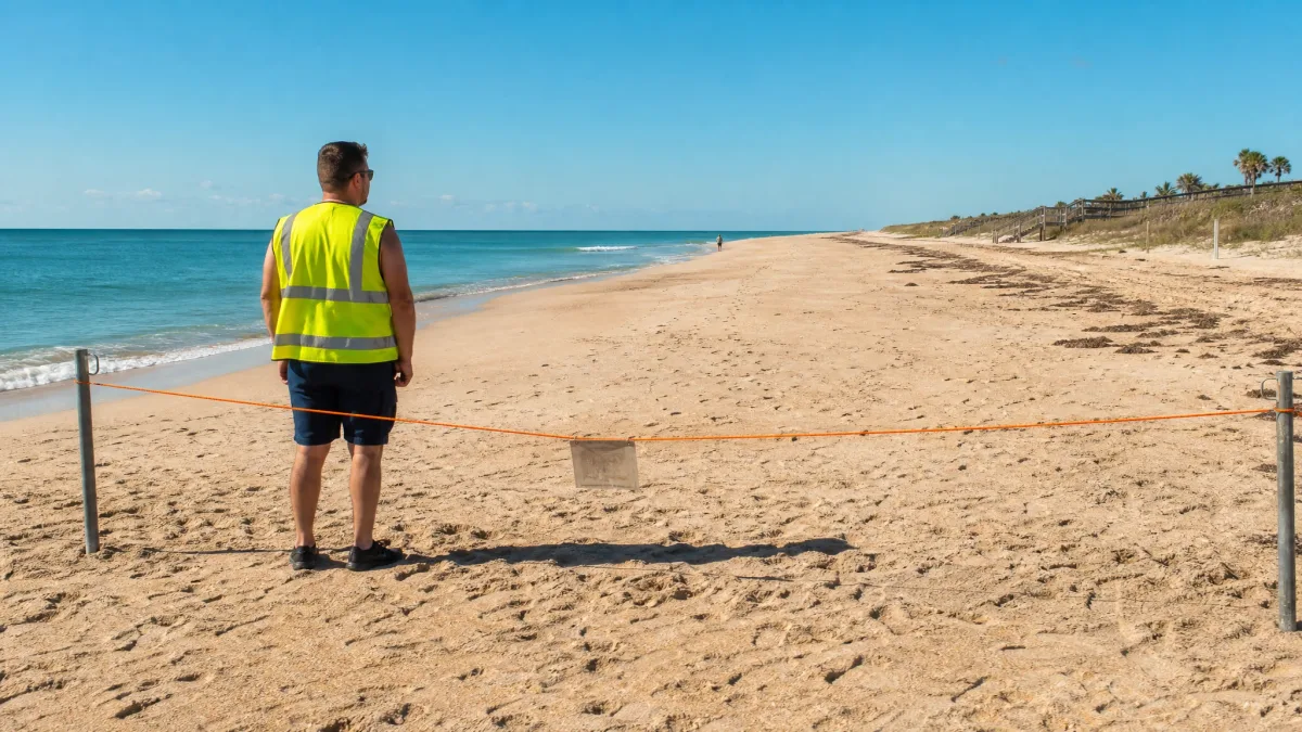
The rope cuts across the sand at shin height, the sign behind it says nothing useful, and the person in the high-vis vest cannot tell you anything beyond the fact that they were asked to stand there.
You drove two hours for this. The tourism page has no update, the parking attendant shrugs, and the sunscreen is already drying on your arms. The absence of a reason is not an oversight – in most closure regimes, the authority that ordered the beach shut has no legal obligation to post why, and the staff at the boundary may have received nothing more than a radio call.
Every closure belongs to a small set of categories, each with its own agency, its own timeline, and its own point at which pushing back makes sense or stops making sense.
Pinning down the category turns a blank sign into a specific problem: a number to call, a database to check, a clock you can actually read. That is what this article gives you.
A Failed Water Test Shuts Beaches Before the Results Are Public

The person at the rope is not withholding information – they genuinely do not have it.
When a water sample pulled from the surf comes back showing bacterial counts above the safety threshold, public health authorities can order a beach shut the same day, before a formal written report has been filed, posted, or passed along to anyone at the beach itself. The lab result triggers the closure; the paperwork catches up later. By the time you arrive and ask the attendant why the sign is there, they have received a one-line instruction that access is suspended – not the reason behind it.
That gap exists because beach staff sit in a completely different chain of command from the testers who flagged the problem. The parks service manages the beach; the county or state health department owns the sample data. Those two agencies may not have spoken since the closure was ordered.
The fast-moving nature of this category cuts both ways. A beach closed hard on Monday morning can reopen Tuesday if follow-up samples clear – the signs come down almost as quickly as they went up. A closure that looks permanent from the outside may have an expiry measured in hours.
Geography narrows the odds. This kind of closure clusters around river mouths, stormwater outflows, and marina edges – anywhere that runoff concentrates near the swim zone. A surf beach with open ocean on all sides and no discharge pipe in sight rarely shuts for bacteria. If the beach you are standing at fits that second description, this probably is not the reason.
For an actual answer, skip the lifeguard station and call the county health department directly. They hold the sample data, they can read you the numbers, and they are the only agency authorised to say when the water is safe again.
⚠️ COMMON MISTAKE
Asking Beach Staff Gets You Nowhere Here
For bacteria and water-quality closures, the ranger or lifeguard on site genuinely has no data — the health department issued the order and the beach authority enforced it. Pressing them harder wastes your time. Call the county health department directly and ask for the beach monitoring line.
Harmful Algal Blooms Close Water That Looks Perfectly Normal
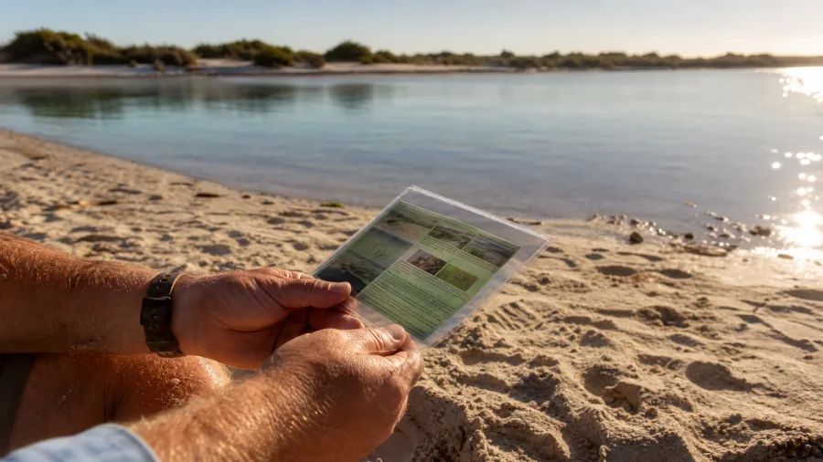
Bacteria live in the water but you cannot see them; a harmful algal bloom can be just as invisible, and the closure warning may arrive before a single cell of it reaches the shoreline.
Monitoring buoys and aerial surveys can detect bloom concentrations several miles offshore. Health authorities use that data to shut coastal access immediately, without waiting for the water in front of you to turn green or brown or give off any smell at all. From the sand, the surface looks completely normal – which is precisely why the sign feels so arbitrary.
What makes this harder to read is that the risk shifts with the species involved. Some bloom-forming organisms cause a rash on contact with skin. Others release airborne compounds that irritate the lungs of people standing on the beach, never touching the water. Others are dangerous only if swallowed – a concern for swimmers, not sunbathers. A posted sign cannot capture all of that in a single line, so it says nothing, and you are left guessing.
The signage problem runs in both directions. Wind and tidal movement can push a bloom out of a closed zone before the sign comes down, leaving you shut out of water that has already cleared. The same forces can push the bloom into an adjacent stretch that has no sign yet. Real-time accuracy is not something static signage can deliver.
Enclosed water is the higher-risk setting. Inland lakes, lagoons, and sheltered bays flush slowly; open surf coastlines with strong tidal exchange are at much lower risk. If you are at a lake or a bay and the closure has no obvious explanation, bloom data is worth checking.
The local parks department will not have it. The NOAA harmful algae dashboard and your state’s coastal monitoring programme are where current bloom locations are logged – and both are searchable by location within a minute or two.
How Quickly Each Closure Type Tends to Resolve
- Filming or Event Permit: Hours to 1-3 days — hard end time written into the permit.
- Shark Sighting: Often expires same day; lifeguard call confirms status in minutes.
- Failed Water Test: 24-72 hours once follow-up samples are collected and cleared.
- Harmful Algal Bloom: Days to weeks depending on wind, tide, and bloom dissipation.
- Federal / Military Operation: No timeline given; can extend indefinitely without notice.
Scale: left = resolves fastest, right = longest or open-ended. Not a guarantee — individual closures vary.
A Shark Sighting Triggers a Closure With No Formal Reopening Notice
A shark sighting closure is about what was near the water recently – and the sign management is where the real problem lies.
In most jurisdictions, one confirmed sighting is all the legal basis required to shut a beach immediately. That part of the process is fast and formal. What follows is neither: there is no official declaration of all-clear, no formal reopening announcement, and no requirement to remove the sign. When the animal stops being observed, the closure simply lapses – and the sign that triggered it can stay on the post for weeks, months, or longer. That sun-bleached laminate you are reading may have been accurate in June and completely irrelevant in August.
Sign condition is therefore the first thing worth reading. A faded, warped notice at a beach with documented shark activity is more likely to be stale than live. A fresh laminated sign, still stiff at the corners, is a different calculation.
One phone call resolves this faster than any other closure category. The local lifeguard station or parks department can tell you within a few minutes whether a sighting-based closure is still considered active. They know, because active closures require them to staff the perimeter – if nobody is being paid to enforce it, it has probably expired.
The geography check matters here too. A cold-water coast or a low-visibility enclosed bay with no history of sightings is unlikely to produce this explanation. The sighting category is most plausible at warmer-water beaches in regions where encounters are regularly logged. If your beach does not fit that description, keep looking.
Some states and regions maintain public sighting registries updated in real time. Searching the beach name alongside ‘shark closure’ and the current date will surface one if it exists – and it will tell you whether the event that triggered the sign is hours or months old.
Storm Damage Keeps a Beach Closed Long After the Weather Clears
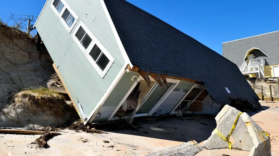
Engineering timescales are slower than animal-behaviour timescales, and the sign at the rope tells you nothing about which one you are on.
Clear water and blue skies after a storm are not the test the authority is applying. The test is whether a licensed inspector has walked the beach and signed off on it – and until that signature exists, the closure holds regardless of how benign the beach looks from the outside. Exposed rebar where a dune face has eroded away, a boardwalk whose footings have been undercut, a car park retaining wall that shifted two inches overnight: these are the legal hazard, and none of them are visible from the rope.
Liability is the engine running this delay.
If an inspector has not yet visited and someone twists an ankle on compromised infrastructure, the authority that lifted the closure prematurely is exposed. Holding the closure until the inspector signs off costs the authority nothing. The cost lands entirely on you, standing at the rope with nowhere else to be. That asymmetry is why precautionary extensions happen even when the actual damage looks minor from the outside.
Developed beaches – the ones with permanent car parks, boardwalks, concession stands, and fixed stairways – stay closed longest for exactly this reason. Every fixture is a liability point requiring individual inspection. An undeveloped stretch with no built infrastructure is a different calculation: the only post-storm hazard there is water conditions, which clear on their own timeline and need no inspector.
This is also the one category where a direct call to the parks or recreation office almost always gets you a real answer. Inspectors are booked on a schedule, and staff know when the next visit is. Ask specifically about storm damage and an inspector’s timeline – that question almost always produces a date.
Beach Closure Categories — At a Glance
🦠 Water Quality
Call county health dept
🌊 Algal Bloom
NOAA HAB Dashboard
🦈 Shark Sighting
Call lifeguard station
🌀 Storm Damage
Ask parks: inspection date
🐦 Wildlife / Nesting
Ranger can name species
🎬 Film / Event Permit
Search city permit portal
Fastest resolution
For any closure, a direct phone call to the right agency beats every website by an average of several hours.
Federal Wildlife Protection Overrides Local Access Decisions Overnight
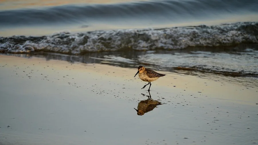
Some closures have no engineering fix waiting at the end and no agency with the power to hurry the process – because the clock is biological, not bureaucratic.
When a protected species nests on a beach, federal law requires immediate closure of that zone. The local parks manager cannot weigh tourism revenue against the legal obligation and decide in favour of access. There is no discretion built into the framework. A single confirmed nest is sufficient, and the closure is in effect from that moment.
The species involved are usually identifiable on site. Sea turtles, piping plovers, and least terns are among the most common triggers on US coastlines. A ranger or warden standing at the boundary can and typically will tell you which species is involved if you ask directly – this is not sensitive information, and most will explain it plainly.
The boundary is not fixed.
As additional nests are confirmed across a season, the closure zone expands. A beach that was partially accessible two weeks ago can be fully off-limits today, with the only notice being fresh rope and new wooden stakes. Nobody is required to send you an update.
Do not accept a specific reopening date from anyone on site. The closure lifts when hatching is confirmed – that is a biological event, not a calendar entry, and any date quoted to you is a guess dressed up as information.
Geography and season filter this one quickly. If the beach has no documented nesting history, or you are visiting outside the spring and summer window, a wildlife closure is unlikely to be the explanation. If it is peak nesting season at a beach with known turtle or shorebird activity, it is probably exactly what it looks like.
Private Shoreline Often Has No Sign Where You Would Expect One
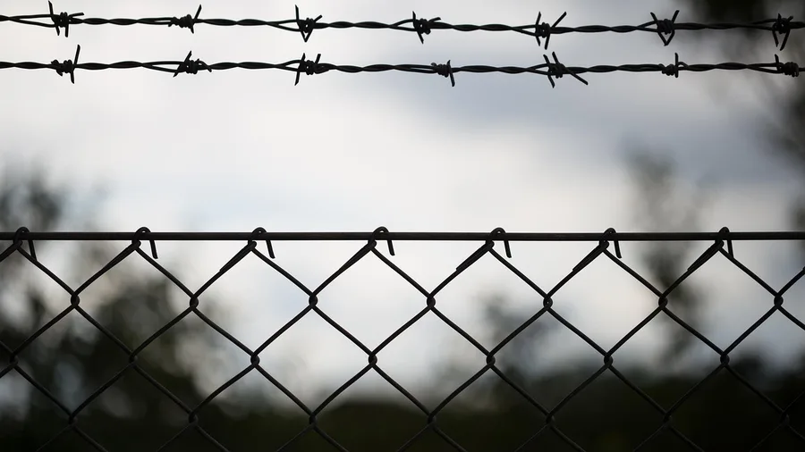
Every closure covered so far has an agency behind it – a health department, a federal wildlife authority, a parks inspector. Private shoreline is different: there is no agency, no closure order, and often no sign, which is precisely why the explanation is absent.
In a large number of US states, private ownership of the beach extends to the mean high-water line. That line sits on the wet sand – the strip where most people walk without a second thought. The dry sand above it and the wet sand below it can both be privately owned, and the beach can look completely indistinguishable from a public one. No marker, no fence, no colour-coded post.
The absence of a sign is not a signal of public access.
Many jurisdictions place no legal obligation on a private shoreline owner to post notice. The owner simply owns it. And a single ‘No Trespassing’ marker placed at one end of a long stretch can, under many state frameworks, apply to the entire length – not just the ground immediately around the sign. You are not safe to interpret it as covering only a small area.
State law is the only source that settles this. Access rights vary so sharply from state to state that no rule of thumb survives the comparison. Travellers arriving from California or Oregon – both states with strong public-trust doctrines that protect broad coastal access – are consistently caught off guard when they visit states where those doctrines are weak or effectively absent. What felt like a guaranteed right at home is a state-specific privilege, not a national one.
Look up the coastal access rules for the specific state before you push back on a closure like this.
💡 PRO TIP
The Coastal Access Map Most People Miss
The Surfrider Foundation maintains a state-by-state coastal access database at surfrider.org. For any beach where ownership is unclear, it is faster than reading the actual state statute and more reliable than asking locals.
Military and Federal Operations Are Not Required to Explain Closures
Private ownership withholds an explanation because no agency is required to give one. Federal operations are different: the agency exists, it knows exactly why the beach is closed, and it is not permitted to tell you.
A beach adjacent to a military base, a rocket launch corridor, or a federal research installation can be cleared with no advance notice, no stated reason, and no posted reopening time. Operational security is a legally sufficient basis for all three absences simultaneously. That is not a gap in the rules – it is the rule.
The staff at the rope know a closure is in effect. They almost certainly do not know why. That is not evasion; it is how federal information flows. The person holding the barrier tape is not in the chain that received the briefing, and asking harder will not change that.
Expect the closure boundary to look oversized. A buffer zone that extends well past any visible activity is standard federal practice – the perimeter reflects operational planning, not the footprint of whatever is actually happening. If it looks disproportionate, that is confirmation, not a mistake worth arguing about.
Do not take the complaint to the town council or the local tourism office. They have no authority here, and local government cannot negotiate with federal jurisdiction. The one useful geography check: if the beach has no documented federal installation nearby, this explanation drops off the list immediately.
Beach Closure — The Numbers Behind the Problem
Tribal Coastal Land Operates Under Sovereign Rules, Not Local Signs
Sovereign authority does not belong only to the federal government. A tribal nation holds it too – and that authority extends to every grain of sand on land it controls, regardless of what the county map or the state coastal-access rules imply about public rights.
The practical consequence is stark: all those doctrines that guarantee public access to dry sand in states like California or Oregon simply do not reach tribal land. The state coastal commission has no jurisdiction. The county parks department cannot override a tribal closure. Whatever access rules you applied everywhere else on this coast, they do not apply here.
Tribal policies toward visitors vary widely. Some nations actively welcome visitors to their coastal land and have published rules for doing so. Others keep it closed to outsiders entirely. Either way, those policies sit with the tribe alone – there is no notification requirement to outside agencies, no mandatory signage, and no state body that tracks changes in real time.
Pushing back on a closure here is not a bureaucratic negotiation. It is a challenge to sovereign law on land that is not governed by the legal framework you arrived with. That distinction matters before you decide how to respond.
The traveller who is genuinely uncertain whether the beach they are standing near falls under tribal jurisdiction has one correct move: call the relevant tribal office directly. Not the county, not the state commission – the tribe. A two-minute call made from the car park almost always produces a clear answer, and it is the only call that reaches the authority that actually holds the answer.
A Permit for Filming or a Private Event Can Close a Public Beach Legally
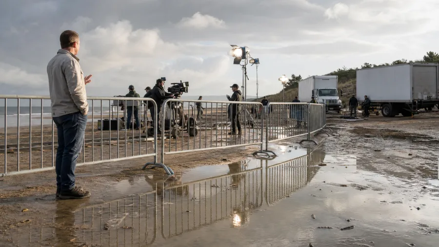
Unlike every category so far, this one comes with a paper trail and an end time. A municipality can issue an exclusive-use permit for a public beach – for a film shoot, a branded competition, a corporate event – and hand over temporary control to a private operator. It is a standard revenue tool in coastal cities and resort towns, not an abuse of process.
The permit system is real, but the public notice around it is often close to zero. A production company can file paperwork a week out, pay the fee, and show up with barriers and security staff on the day – and no press release will have gone out. The people standing at the rope may not even know the name of the company they are working for.
the permit is a public document, filed with the city or county that issued it. Searching the local permit portal for the beach name takes about three minutes and will usually return the permit, the permit holder, and – critically – the exact end time. That end time is binding. The beach comes back on schedule.
Typical exclusive-use windows run one to three days. A shoot that blocks the beach on a Saturday morning is almost always gone by Sunday evening at the latest. No other closure type in this list offers that level of certainty about when things return to normal.
If the search surfaces a permit with a clear end time, you have everything you need to decide: come back tomorrow, or find an alternative for today. This is the one scenario where a blank sign at the barrier actually has a complete and findable explanation – it just requires you to look one level up from the beach.
Worth Waiting Out vs. Move On
Worth Waiting
- Failed water test — follow-up samples often clear within 24 hours
- Shark sighting — call lifeguard; closure may already be lifted
- Film or event permit — exact end time is in the public record
- Storm damage — ask parks for the inspection date and plan around it
Move On
- Federal or military operation — no timeline, no negotiation
- Active nesting season closure — lifts at hatching, not a calendar date
- Tribal land closure — no external authority can override it
- Private shoreline with no public access rights in your state
The Official Explanation Exists — It Just Is Not at the Beach
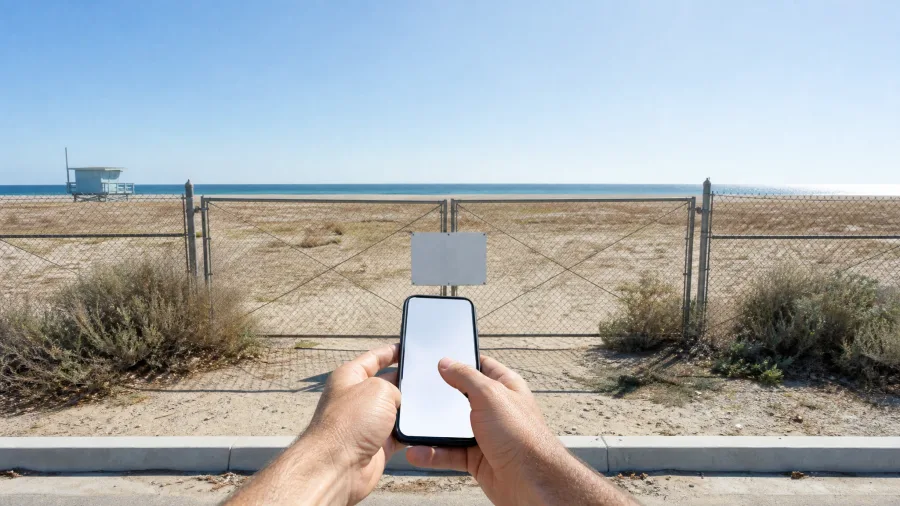
Every category covered in this article generates a paper trail – the record just lives somewhere other than the beach itself.
Three sources cover most closure types. The county health department website holds water-quality and bacteria data, usually updated within hours of a new sample result. The state beach-monitoring programme covers broader coastal conditions – storm damage assessments, erosion closures, anything that crosses local authority lines. For bloom-related shutdowns, the NOAA harmful algae dashboard is the single most current national source, and it maps by coastline so you can check neighboring stretches at the same time.
Before you make a single call, open a search engine and type the beach name, the word ‘closure’, and today’s date. That combination pulls official press releases, county health advisories, and state agency bulletins to the top of results – and it typically takes less time than walking back to your car.
A phone call to the local parks or recreation department beats any website for speed. The staff member who answers may not know the scientific reason, but they almost always know which agency ordered the closure – and a name plus a department number gets you to an actual answer in one more call.
If that search and that call both come up empty, the closure may be precautionary, informal, or in rare cases not formally authorized at all. That is not a reason to ignore it, but it is grounds to ask the person at the rope whether the closure is enforceable and who specifically issued it – a question they should be able to answer.
🔍 Ten-Minute Field Check for Any Unexplained Closure
Check the sign closely
Look for a posting date, a permit number, or an issuing agency name — any of these tells you which body to contact.
Ask the person at the rope
They may not know the reason, but they usually know who ordered the closure — get that agency name.
Run a targeted search
Search the beach name plus 'closure' plus today's date; a filed record surfaces in under two minutes if one exists.
Call the right agency
County health for bacteria, lifeguard station for sightings, parks department for storm or event permits, tribal office for tribal land.
Decide: wait or drive
If the closure has a clear end time or a sample-based mechanism, waiting is reasonable; if it is federal, wildlife, or tribal, move on.
Frequently Asked Questions
Can a beach be closed without any sign posted at all?
Yes, in several categories. Private shoreline in many US states requires no posted notice. Tribal land closures may not be signed at all entry points. Military perimeter closures are sometimes marked only at one access road. The absence of a sign does not mean access is legal — it means you need to check land status before assuming it is public.
How do I find out if a beach failed a water quality test?
Go directly to the county health department website and look for a beach monitoring or water quality page. Most coastal counties publish real-time or daily test results. If the site is not updated, call the health department’s environmental health line — they are required to keep these records and almost always answer the question promptly.
Is it possible to get onto a beach that has a filming permit?
Not during the permitted window, even though it is a public beach — the exclusive-use permit gives the permit holder temporary legal control of that access. Look up the permit in the city or county portal to find the exact end time, then return after it expires. The beach reverts to full public access the moment the permit period ends.
How long do beach closures typically last?
It depends entirely on the cause. A shark sighting closure can lift the same day; a bacteria closure typically clears in 24 to 72 hours once resampling begins. Storm damage closures depend on when an inspector visits, which can stretch over several days. Wildlife nesting closures last weeks to months. Federal operational closures have no set end date.
What is the difference between a beach closure and a beach advisory?
A closure means you are prohibited from entering the water or the beach area. An advisory means the water is open but conditions — elevated bacteria, jellyfish, or strong currents — carry a health or safety warning. Some advisories are posted as warnings without any enforcement, while closures are backed by legal authority. If you are unsure which applies, call the county health department.
Can I get in trouble for ignoring a beach closure sign?
Yes, and the severity depends on the type. Ignoring a health-department closure carries a potential fine in most states. Entering federal land or a military buffer zone after a posted closure can result in removal by federal officers and possible trespass charges. Entering tribal land without permission is a sovereign trespass matter, not just a local ordinance. Only an event-permit closure has relatively mild consequences — though you will still be asked to leave.
Check the Source, Not the Sign — and Know When a Different Beach Is the Answer
Start with one search: the beach name, the word closure, and today’s date. Thirty seconds, run it now, and it covers most formal closure types – water quality advisories, wildlife protection orders, permit records. If that surfaces nothing, call the local parks or recreation department directly. One number, one question, and you will have a named responsible agency inside five minutes. If the closure looks water-based, follow that call with the county health department, which holds the actual sample data and is the only body authorised to say when the water is cleared.
If neither search nor call produces a record, the closure may be informal or purely precautionary – and you now have standing to ask the person at the rope whether it is enforceable and who specifically issued it. That question, asked politely, almost always produces either a real answer or a visible hesitation that tells you something on its own.
Most closures are short, most have a paper trail, and most dissolve faster than the blank sign suggests. But if the search is empty, the call goes nowhere, and the nearest official cannot name an issuing agency, the rope strung across that sand is your answer. A beach thirty minutes up the coast with open water is always the better outcome than an hour spent arguing with a sign that was never going to talk back. Finding a quiet, uncrowded alternative is easier than most travelers expect, and overlooked beach towns worth the detour still exist along many coastlines.
Not Sure Which Category Your Closure Falls Into?
Work through the Ten-Minute Field Check above — it routes you to the right agency for every type covered in this article, so you spend your time on the beach, not the phone.