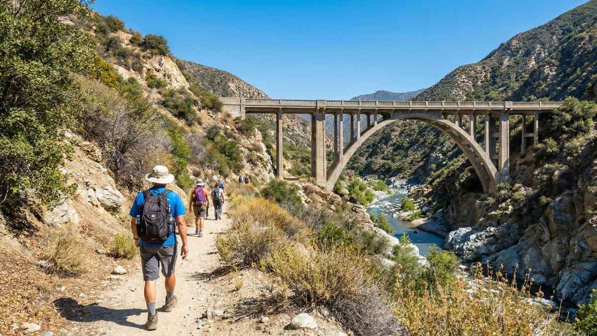
14 Deadly Trails in USA Experienced Hikers Attempt Once (And Never Again)
Fear doesn’t always arrive with drama. Sometimes it shows up quietly, halfway up a climb, when legs start shaking for reasons that have nothing to do with fatigue. These are the kinds of trails that strip hiking down to instinct and judgment, where confidence is tested step by step, and mistakes carry weight.
The views can be unforgettable, but they come at a cost—exposure, exhaustion, weather that turns without warning, and moments where turning back feels just as risky as moving forward.
Experienced hikers attempt routes like these for the challenge, the stories, and the lessons. Most walk away changed. Few ever feel the need to return.
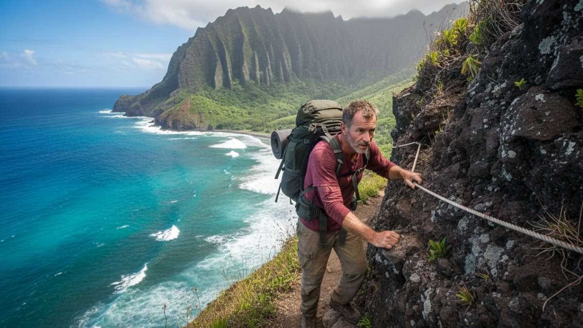
1. Kalalau Trail (Hawaii)
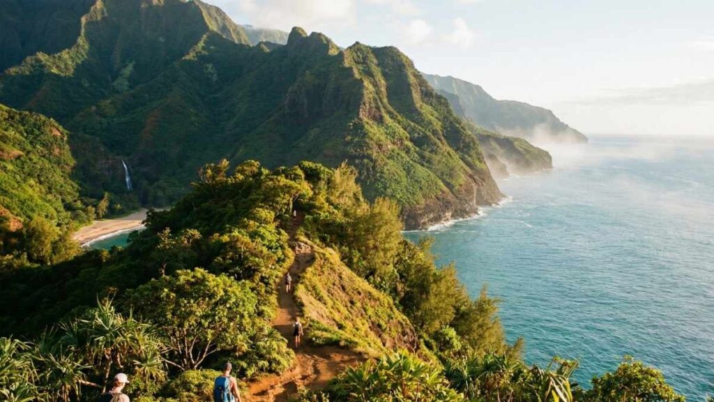
Kalalau isn’t just a hike—it’s a prolonged test of nerve, endurance, and judgment. Stretching along the Nā Pali Coast, the trail clings to sea cliffs that plunge straight into the Pacific. One misstep on muddy sections can mean a slide with no second chances. The scenery is jaw-dropping, but the danger is constant, especially where the path narrows to barely boot-width.
What makes Kalalau especially lethal is how fast conditions change. A sunny start can turn into pounding rain within minutes, transforming dry dirt into slick clay. Streams swell without warning, cutting off exits and trapping hikers overnight. Many incidents happen not from exhaustion, but from underestimating how unforgiving this trail becomes when the weather shifts.
Even experienced hikers report a mental fatigue here—hours of exposure, wind, and uneven footing force constant focus. By the time you reach the end, the sense of relief outweighs the sense of triumph, which says everything about why most people only attempt it once.
Key Info
- Best Months: May to September
- Distance: 11 miles one way
- Permit Required: Yes (strictly enforced)
- Main Dangers: Flash floods, cliff exposure, landslides
- Skill Level: Expert only
2. Angel’s Landing (Utah)
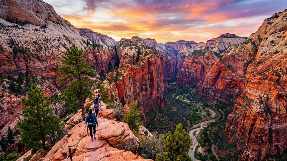
Angel’s Landing earns its reputation not through length, but exposure. The final half-mile rises sharply along a narrow sandstone spine with sheer drops on both sides. Chains bolted into the rock are the only thing separating you from a fall of over 1,000 feet. The climb demands upper-body strength, balance, and nerves that don’t betray you under pressure.
Crowds add another layer of danger. Hikers moving in both directions must pass each other on ledges barely wide enough for one person. A single slip, panic freeze, or careless shove can create a chain reaction. Rangers frequently turn people back—not for lack of fitness, but because fear takes over mid-ascent.
Those who finish often describe the summit as emotionally overwhelming rather than celebratory. The view is unforgettable, but so is the awareness of how close things came to going wrong. It’s thrilling, terrifying, and not something most feel compelled to repeat.
Key Info
- Best Months: March to May, September to November
- Distance: 5.4 miles round trip
- Permit Required: Yes (lottery system)
- Main Dangers: Extreme exposure, crowd congestion
- Skill Level: Advanced with a strong head for heights
3. Half Dome Cable Route (California)
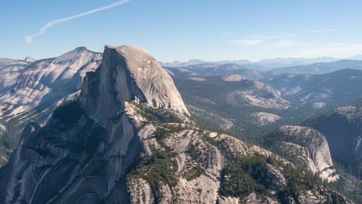
Half Dome’s cable route looks manageable from afar, but the reality hits once the slope steepens to nearly vertical. The final ascent involves pulling yourself up slick granite slabs using steel cables, with hundreds of feet of open air below. When the weather turns, the rock becomes dangerously smooth—fatal accidents often happen during sudden storms.
The physical challenge is relentless. By the time hikers reach the cables, they’ve already climbed thousands of feet. Fatigue makes grip weaker and judgment slower. Descending is even more nerve-racking, as hikers must face outward while navigating traffic coming up.
Many who complete Half Dome describe it as mentally heavier than physically hard. Every step demands attention. The reward is iconic, but the stress lingers long after the hike ends—enough to convince many that once is enough.
Key Info
- Best Months: June to September
- Distance: ~16 miles round trip
- Permit Required: Yes (highly competitive)
- Main Dangers: Slippery granite, lightning, exhaustion
- Skill Level: Expert endurance hikers
4. Huntington Ravine Trail (New Hampshire)
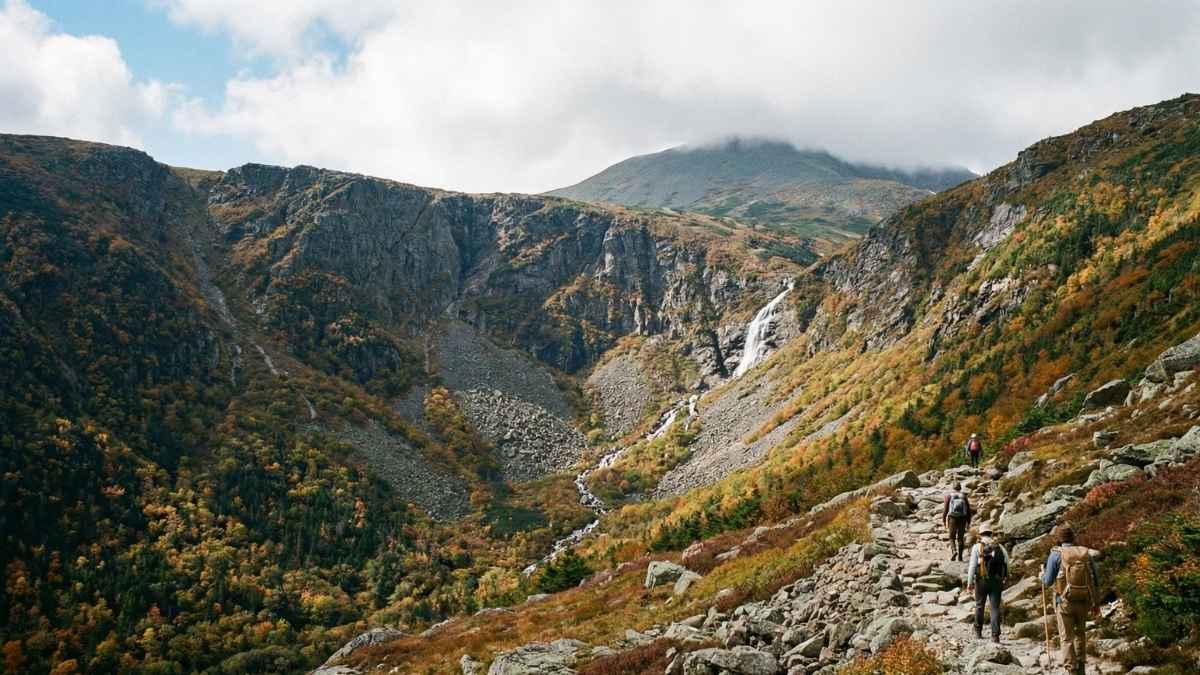
Huntington Ravine is not a traditional hiking trail—it’s a steep alpine climb masquerading as one. Located on Mount Washington, the route ascends through exposed rock slabs where hands are just as necessary as feet. The weather here is notoriously violent, even in summer, with sudden temperature drops and hurricane-force winds.
The trail offers little margin for error. A slip on wet rock can send a hiker tumbling hundreds of feet. Fog frequently reduces visibility to near zero, turning navigation into guesswork. Rescue operations are common, difficult, and dangerous even for professionals.
Those who complete Huntington Ravine often say the mountain felt actively hostile. It’s raw, technical, and demands respect at every turn. Many experienced hikers consider it a badge of honor—and a once-in-a-lifetime ordeal.
Key Info
- Best Months: July to early September
- Distance: ~2.6 miles (very steep)
- Permit Required: No
- Main Dangers: Sudden weather shifts, rock falls
- Skill Level: Expert alpine hikers
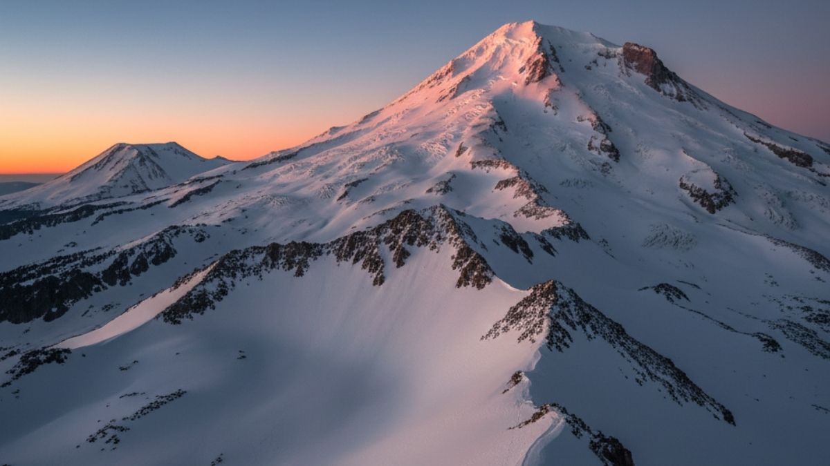
5. Mount Hood – Pearly Gates Route (Oregon)
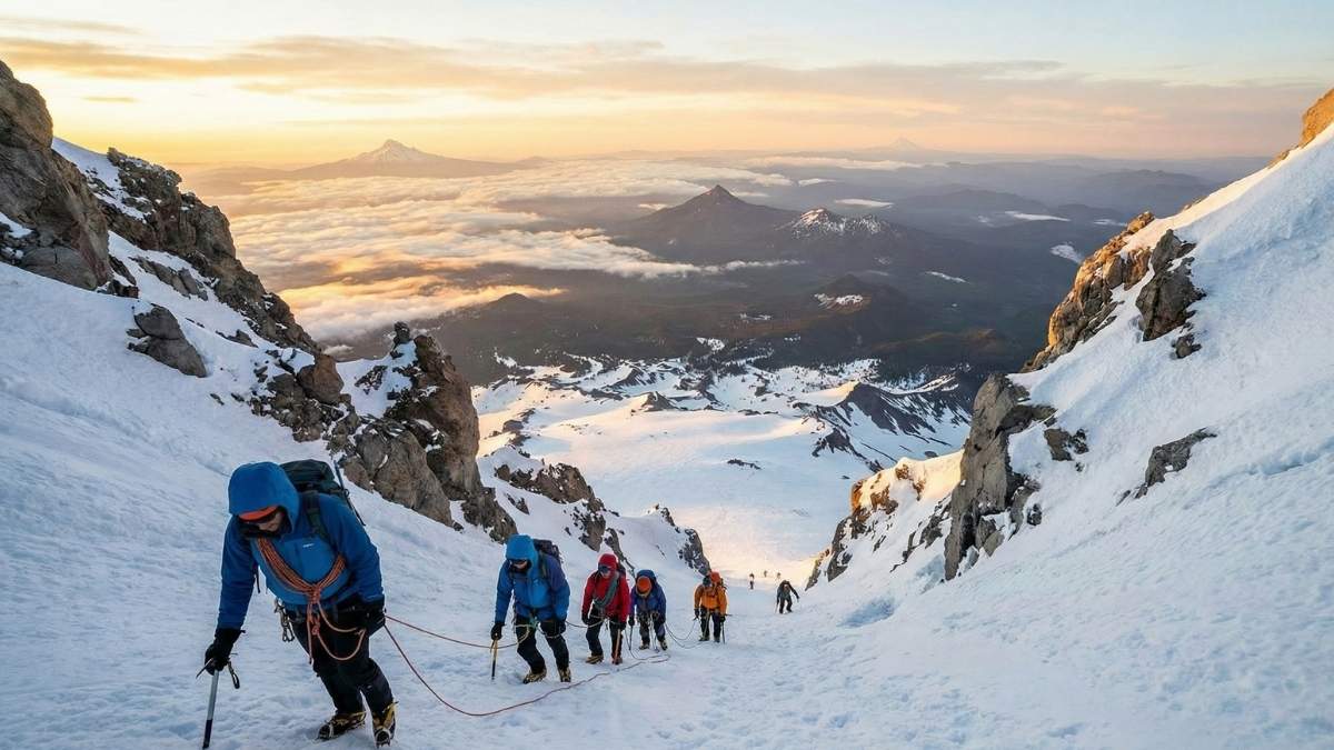
Mount Hood’s Pearly Gates route is deceptively popular—and that’s part of the danger. The climb funnels hikers into narrow ice chutes near the summit, where steep snow, falling ice, and overcrowding combine into a high-risk bottleneck. A single slip here can trigger an uncontrollable slide.
Conditions change hour by hour. What feels firm and manageable early in the morning can turn icy or slushy by midday. Many accidents occur during descent, when fatigue sets in, and footing becomes unreliable. Proper mountaineering gear isn’t optional—it’s survival equipment.
Reaching the summit brings satisfaction, but also relief. The mountain demands constant technical awareness, and mistakes are rarely forgiven. Even seasoned climbers often say that one successful ascent is enough.
Key Info
- Best Months: May to early July
- Distance: ~7 miles round trip
- Permit Required: No (but registration recommended)
- Main Dangers: Ice falls, steep snow slopes
- Skill Level: Expert mountaineers only
6. Longs Peak – Keyhole Route (Colorado)
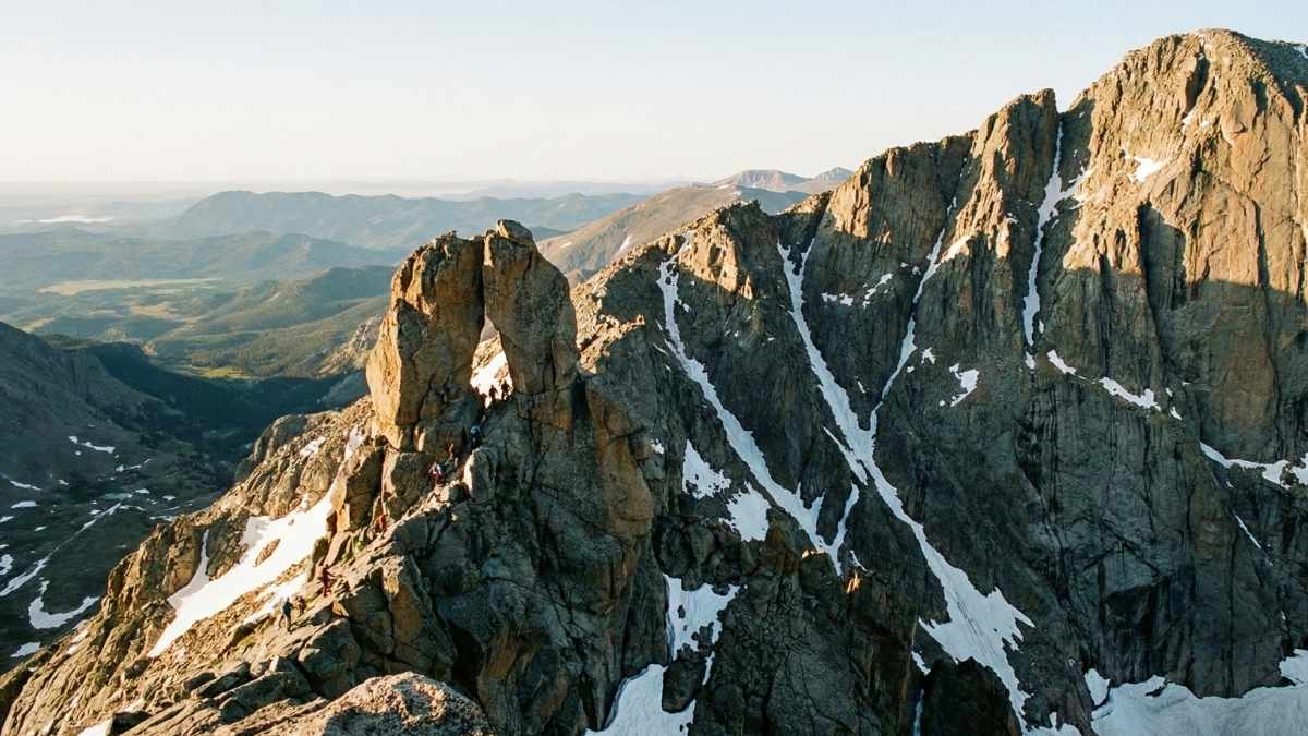
Longs Peak’s Keyhole Route is infamous because it lures strong hikers into alpine terrain that feels manageable—until it suddenly isn’t. What begins as a long but straightforward hike turns technical above the treeline, where exposure, scrambling, and rapidly changing weather dominate every decision. Thunderstorms roll in fast here, often with no warning and no safe shelter.
The most dangerous section comes after the Keyhole itself. Narrow ledges, loose rock, and steep drop-offs require constant attention. Route-finding mistakes are common, especially in fog or snow, and even a minor error can escalate quickly at 14,000 feet. Altitude fatigue doesn’t help, dulling reaction time right when precision matters most.
Many hikers reach the summit only to realize the descent is harder mentally than the climb. Weather windows close fast, and exhaustion sets in at the worst possible moment. Those who finish often describe it as humbling rather than exhilarating.
Key Info
- Best Months: July to early September
- Distance: ~15 miles round trip
- Permit Required: No (registration recommended)
- Main Dangers: Lightning, exposure, route-finding errors
- Skill Level: Expert high-altitude hikers
7. Mount Whitney – Mountaineers Route (California)
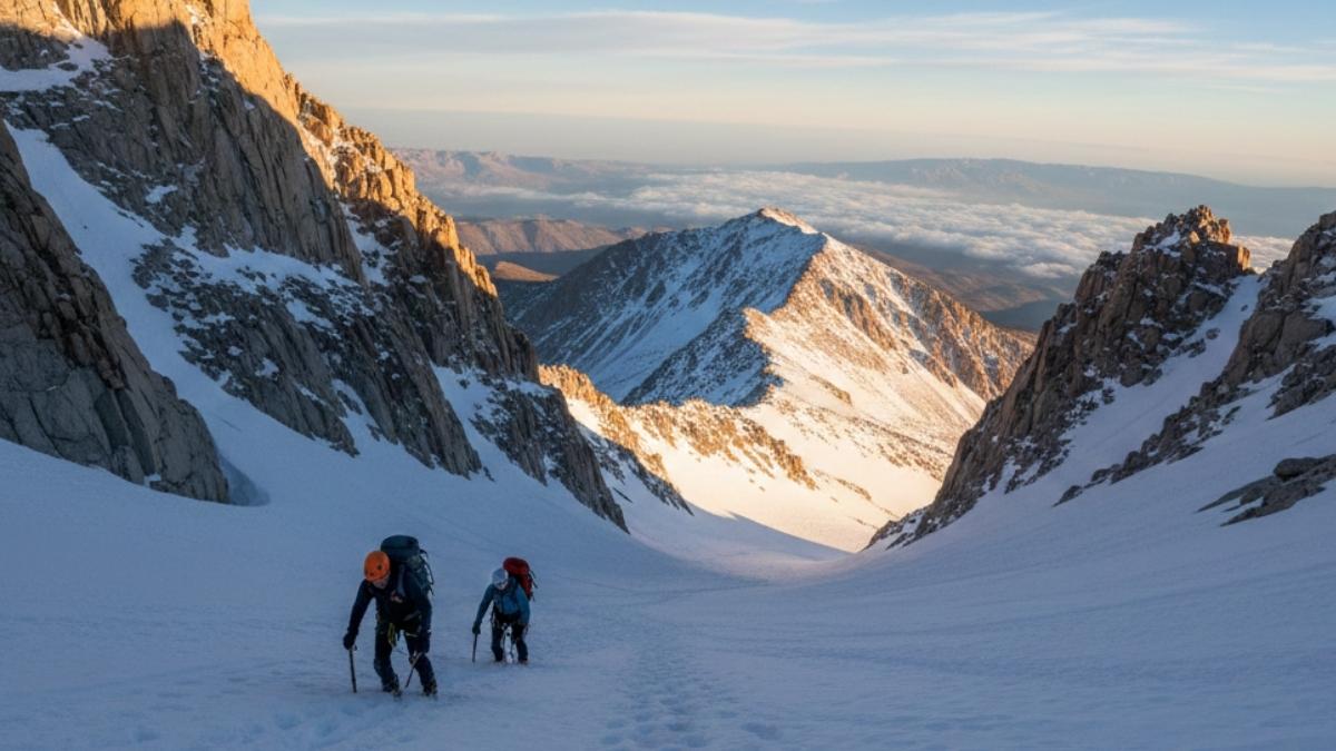
The Mountaineers Route skips the comfort of switchbacks and goes straight for steep, unforgiving terrain. Unlike the standard trail, this route demands technical scrambling, snow travel, and comfort on unstable rock. The famous “Final 400” feet is a steep chute that becomes dangerously icy outside peak summer.
Altitude is the silent threat here. Even strong hikers feel the effects above 13,000 feet, where nausea and dizziness can turn minor obstacles into serious hazards. Weather can swing from clear skies to high winds and snow in a matter of hours, forcing tough calls mid-climb.
Completing the route feels less like checking off a summit and more like surviving a calculated risk. Many who attempt it say the mental strain outweighs the physical effort—and once is enough to satisfy curiosity.
Key Info
- Best Months: July to September
- Distance: ~10 miles round trip
- Permit Required: Yes
- Main Dangers: Altitude sickness, loose rock, snow chutes
- Skill Level: Expert alpine hikers
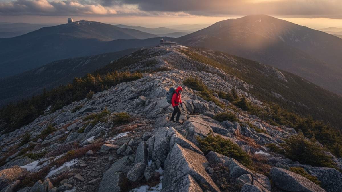
8. Mount Katahdin – Knife Edge Trail (Maine)
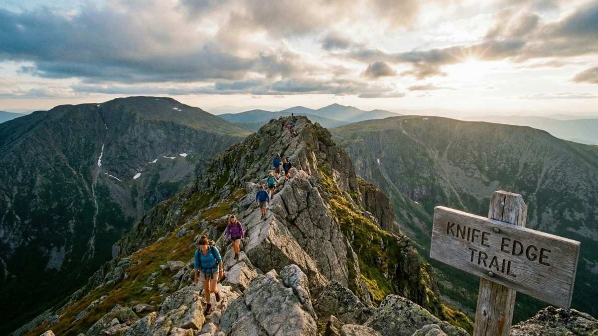
Knife Edge isn’t long, but it’s relentless. The trail follows a narrow ridge with sheer drops on both sides, often no wider than a few feet. Wind gusts can be powerful enough to knock hikers off balance, and weather changes rapidly at elevation.
There’s no casual walking here—every step demands attention. Scrambling over boulders with constant exposure tests confidence and stamina simultaneously. Turning back mid-route isn’t always easy, which adds psychological pressure as conditions worsen.
Those who cross Knife Edge often describe a strange mix of awe and unease. The views are spectacular, but the sense of vulnerability never fades. It’s unforgettable—and for most, not something worth repeating.
Key Info
- Best Months: July to September
- Distance: ~1.1 miles (within longer summit hike)
- Permit Required: No
- Main Dangers: High winds, exposure, sudden storms
- Skill Level: Advanced to expert
9. Bright Angel Trail (Extreme Summer Heat) – Arizona
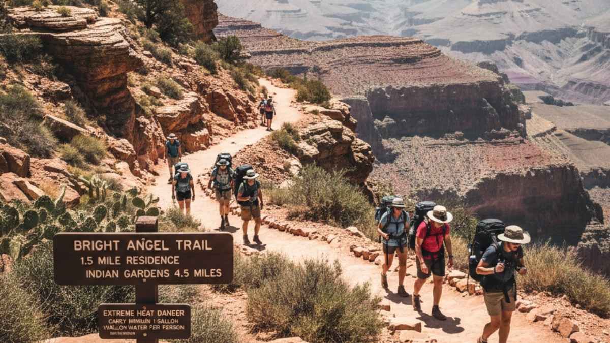
Bright Angel Trail becomes deadly not because of technical difficulty, but because of heat—and false confidence. Descending into the Grand Canyon feels easy at first, luring hikers deeper while temperatures climb relentlessly. Summer heat regularly exceeds 110°F (43°C) in the inner canyon.
The danger lies in the return climb. Legs weaken, dehydration sets in, and shade disappears. Many rescues involve hikers who underestimated how brutal the ascent would be after hours of heat exposure. Water sources can dry up, and help may be hours away.
Veteran hikers often say this trail taught them respect the hard way. It’s not dramatic cliffs or narrow ledges—it’s endurance, planning, and humility that decide outcomes here.
Key Info
- Best Months: October to April
- Distance: Up to 12 miles round trip
- Permit Required: No
- Main Dangers: Heat exhaustion, dehydration
- Skill Level: Experienced desert hikers
10. Mount Rainier – Disappointment Cleaver Route (Washington)
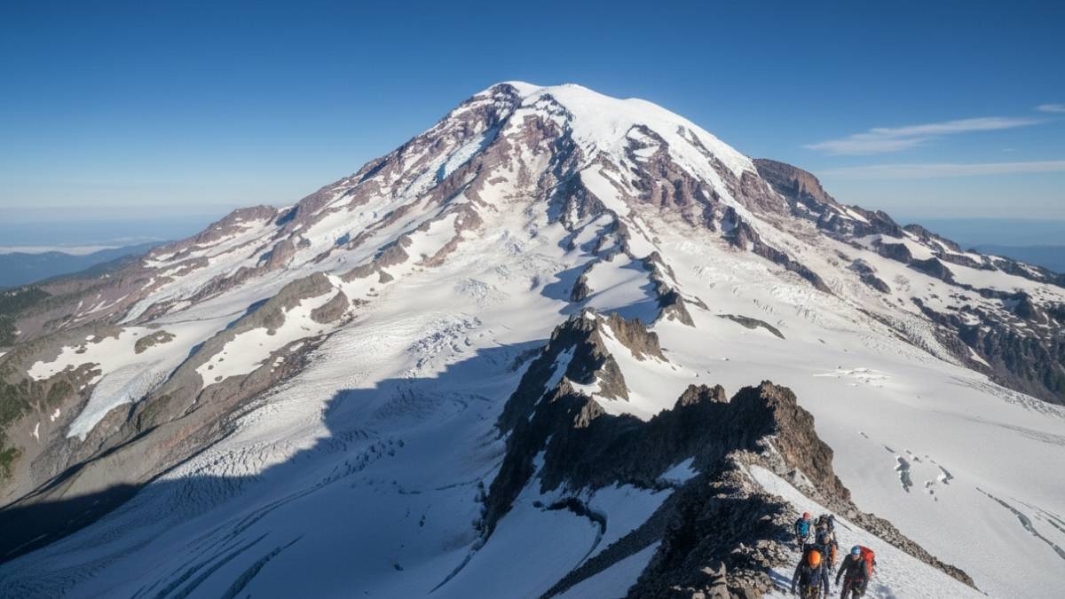
Despite being the most popular route on Mount Rainier, Disappointment Cleaver is far from safe. Glacier travel introduces crevasses, icefalls, and snow bridges that can collapse without warning. Even guided climbers face real risk here.
The climb demands technical gear and constant awareness. Weather shifts rapidly, with whiteout conditions capable of erasing visibility. Altitude compounds fatigue, making simple tasks harder at precisely the wrong time.
Summiting Rainier is an achievement, but most climbers agree the experience is mentally draining rather than joyful. The mountain demands absolute focus, and many leave satisfied—but with no desire to repeat the stress.
Key Info
- Best Months: May to July
- Distance: ~8–10 miles round trip
- Permit Required: Yes
- Main Dangers: Crevasses, avalanches, severe weather
- Skill Level: Expert mountaineers
11. Mount Shasta – Avalanche Gulch Route (California)
Avalanche Gulch has a friendly name and a not-so-friendly reality. The route draws in ambitious hikers because it’s considered the “standard” way up Mount Shasta, yet it delivers steep snow slopes, rockfall hazards, and rapidly deteriorating weather. What feels approachable early in the day can turn hostile within hours.
As the sun rises, the snow softens, and footing becomes unreliable. Above treeline, there’s nowhere to hide from wind or sudden storms. Rock and ice tumble down the chute as temperatures shift, turning the descent into a race against fatigue and gravity.
Many who finish the climb admit the mountain demanded far more than expected. It’s not flashy danger—it’s persistent, grinding risk that builds until the summit feels less like victory and more like escape.
Key Info
- Best Months: May to July
- Distance: ~7 miles round trip
- Permit Required: Yes (summit pass)
- Main Dangers: Rockfall, snow slides, altitude
- Skill Level: Expert snow climbers
12. Presidential Traverse (New Hampshire)
The Presidential Traverse doesn’t rely on cliffs or technical moves to be deadly—it relies on endurance and exposure. Crossing multiple summits above treeline means hours of walking in fully open terrain, where weather dominates every decision. Conditions can shift from calm to life-threatening in minutes.
There’s no easy exit once committed. Wind chills drop fast, visibility vanishes in fog, and footing turns treacherous on wet rock. Even strong hikers underestimate how draining constant exposure can be, especially when storms roll in mid-traverse.
Those who complete it often say the real challenge wasn’t strength, but staying sharp for so long. It’s a marathon of focus, and by the end, survival feels like the true accomplishment.
Key Info
- Best Months: July to September
- Distance: ~23 miles
- Permit Required: No
- Main Dangers: Extreme weather, exposure, exhaustion
- Skill Level: Expert endurance hikers
13. Devil’s Path (New York)
Devil’s Path earns its reputation through sheer brutality. Steep ascents, near-vertical scrambles, and relentless elevation changes define every mile. There’s very little rhythm to the hike—just constant up, down, and over obstacles that punish tired legs.
Wet conditions make the route especially dangerous. Slippery rock slabs and mud-covered roots turn basic moves into calculated risks. Injuries are common, and rescues can take hours due to the rugged terrain.
Finishing Devil’s Path leaves hikers feeling wrung out rather than accomplished. It’s a raw, unforgiving experience that strips hiking down to its most basic demand: keep moving, no matter how tired you are.
Key Info
- Best Months: May to October
- Distance: ~24 miles
- Permit Required: No
- Main Dangers: Slippery scrambles, fatigue
- Skill Level: Advanced to expert
14. Maroon Bells – Four Pass Loop (Colorado)
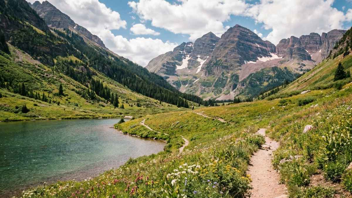
The Four Pass Loop looks harmless on paper, but altitude turns this scenic circuit into a quiet test of endurance. Crossing four high passes above 12,000 feet means thin air, fast-changing weather, and long days that slowly sap energy.
Afternoon storms are common, especially in summer. Lightning, hail, and sudden temperature drops can catch hikers far from shelter. Navigation becomes tricky in fog, and exhaustion increases the chance of missteps on steep descents.
Many hikers finish the loop stunned by how demanding it felt. The beauty never lets up—but neither does the strain. It’s a trail that teaches respect through persistence rather than fear.
Key Info
- Best Months: July to September
- Distance: ~28 miles
- Permit Required: Yes
- Main Dangers: Altitude fatigue, storms, exposure
- Skill Level: Experienced multi-day hikers